

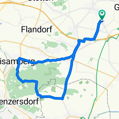
Schulgasse 22, Enzersfeld nach Fleischgasse, Mannersdorf am Leithagebirge
A cycling route starting in Enzersfeld, Lower Austria, Austria.
Overview
About this route
- 3 h 25 min
- Duration
- 57 km
- Distance
- 236 m
- Ascent
- 218 m
- Descent
- 16.7 km/h
- Avg. speed
- ---
- Avg. speed
Route quality
Waytypes & surfaces along the route
Waytypes
Cycleway
22.7 km
(40 %)
Busy road
10 km
(18 %)
Surfaces
Paved
42 km
(74 %)
Unpaved
5.7 km
(10 %)
Asphalt
40.6 km
(71 %)
Gravel
4.5 km
(8 %)
Continue with Bikemap
Use, edit, or download this cycling route
You would like to ride Schulgasse 22, Enzersfeld nach Fleischgasse, Mannersdorf am Leithagebirge or customize it for your own trip? Here is what you can do with this Bikemap route:
Free features
- Save this route as favorite or in collections
- Copy & plan your own version of this route
- Sync your route with Garmin or Wahoo
Premium features
Free trial for 3 days, or one-time payment. More about Bikemap Premium.
- Navigate this route on iOS & Android
- Export a GPX / KML file of this route
- Create your custom printout (try it for free)
- Download this route for offline navigation
Discover more Premium features.
Get Bikemap PremiumFrom our community
Other popular routes starting in Enzersfeld
 Runde Marchfeldkanal, Donau
- Distance
- 34.2 km
- Ascent
- 454 m
- Descent
- 222 m
- Location
- Enzersfeld, Lower Austria, Austria
 dampfross&drahtessel - marchfeldkanal
- Distance
- 31 km
- Ascent
- 37 m
- Descent
- 36 m
- Location
- Enzersfeld, Lower Austria, Austria
 Bisamberg Runde
- Distance
- 18.1 km
- Ascent
- 253 m
- Descent
- 254 m
- Location
- Enzersfeld, Lower Austria, Austria
 Quer durchs Weinviertel PowerTrail
- Distance
- 79.9 km
- Ascent
- 661 m
- Descent
- 663 m
- Location
- Enzersfeld, Lower Austria, Austria
 Langer Graben 3, Enzersfeld im Weinviertel nach Parkring 2a/1, Bisamberg
- Distance
- 6.5 km
- Ascent
- 53 m
- Descent
- 66 m
- Location
- Enzersfeld, Lower Austria, Austria
 Hagenbrunn - 31,2km - Deutsch Wagram - Pillichsdorf - Eibesbrunn
- Distance
- 31.2 km
- Ascent
- 25 m
- Descent
- 26 m
- Location
- Enzersfeld, Lower Austria, Austria
 Enzersfeld Gemeindeamt, Enzersfeld im Weinviertel nach Enzersfeld Gemeindeamt, Enzersfeld im Weinviertel
- Distance
- 55.5 km
- Ascent
- 296 m
- Descent
- 293 m
- Location
- Enzersfeld, Lower Austria, Austria
 Manhartsbrunn I (Enzersfeld)
- Distance
- 3.9 km
- Ascent
- 167 m
- Descent
- 20 m
- Location
- Enzersfeld, Lower Austria, Austria
Open it in the app