
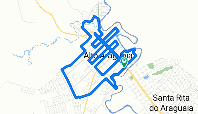
Anel Costurado
A cycling route starting in Alto Araguaia, Mato Grosso, Brazil.
Overview
About this route
- 1 h 19 min
- Duration
- 15 km
- Distance
- 135 m
- Ascent
- 127 m
- Descent
- 11.3 km/h
- Avg. speed
- ---
- Avg. speed
Route quality
Waytypes & surfaces along the route
Waytypes
Quiet road
12 km
(80 %)
Cycleway
2.9 km
(20 %)
Undefined
0 km
(<1 %)
Surfaces
Paved
2.9 km
(20 %)
Asphalt
2 km
(13 %)
Paved (undefined)
1 km
(6 %)
Undefined
12 km
(80 %)
Continue with Bikemap
Use, edit, or download this cycling route
You would like to ride Anel Costurado or customize it for your own trip? Here is what you can do with this Bikemap route:
Free features
- Save this route as favorite or in collections
- Copy & plan your own version of this route
- Sync your route with Garmin or Wahoo
Premium features
Free trial for 3 days, or one-time payment. More about Bikemap Premium.
- Navigate this route on iOS & Android
- Export a GPX / KML file of this route
- Create your custom printout (try it for free)
- Download this route for offline navigation
Discover more Premium features.
Get Bikemap PremiumFrom our community
Other popular routes starting in Alto Araguaia
 Passeio rápido em Alto Araguaia
- Distance
- 25.5 km
- Ascent
- 327 m
- Descent
- 260 m
- Location
- Alto Araguaia, Mato Grosso, Brazil
 De Rua Santa Rita, 2–98, Alto Araguaia a Rua Santa Rita, 1–99, Alto Araguaia
- Distance
- 13.7 km
- Ascent
- 131 m
- Descent
- 130 m
- Location
- Alto Araguaia, Mato Grosso, Brazil
 De Rua Santa Rita, 1–99, Alto Araguaia a Rua Santa Rita, 1–99, Alto Araguaia
- Distance
- 12.5 km
- Ascent
- 185 m
- Descent
- 117 m
- Location
- Alto Araguaia, Mato Grosso, Brazil
 De Rua Benjamin Constant, 711–823, Alto Araguaia a BR-364, Santa Rita do Araguaia
- Distance
- 9.4 km
- Ascent
- 164 m
- Descent
- 56 m
- Location
- Alto Araguaia, Mato Grosso, Brazil
 Alto Araguaia - Alto Garças
- Distance
- 66.4 km
- Ascent
- 748 m
- Descent
- 639 m
- Location
- Alto Araguaia, Mato Grosso, Brazil
 De Avenida Jerônimo Samita Maia, Alto Araguaia a Avenida Jerônimo Samita Maia, Alto Araguaia
- Distance
- 8.8 km
- Ascent
- 0 m
- Descent
- 0 m
- Location
- Alto Araguaia, Mato Grosso, Brazil
 De Rua Benjamin Constant, 593–709, Alto Araguaia a BR-364, Santa Rita do Araguaia
- Distance
- 10.9 km
- Ascent
- 164 m
- Descent
- 59 m
- Location
- Alto Araguaia, Mato Grosso, Brazil
 De Rua Santa Rita, 1–99, Alto Araguaia a Rua Santa Rita, 1–99, Alto Araguaia
- Distance
- 20.9 km
- Ascent
- 200 m
- Descent
- 199 m
- Location
- Alto Araguaia, Mato Grosso, Brazil
Open it in the app