V.Myšľa -Karolka-Vlašske luky-V.Milič
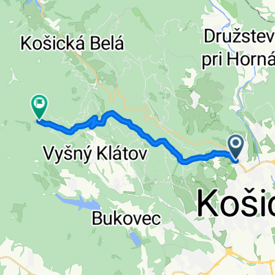
A cycling route starting in Košice, Košický kraj, Slovak Republic.
Overview
About this route
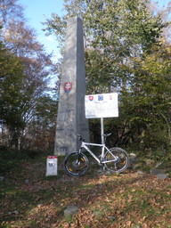
Pestra trasa na najvyšši bod slovensko-maďarskej hranice. Hranica je trošku naročnejsia, treba občas potlačiť bicykel.
Aby ste nezabludili treba: -zabočiť do prava z asfaltovej cesty na lesnu vtedy keď sa cesta bude po stupani lomiť do klesania.(cca na 6-7km.) -za Miličom cca 1km po hranici, zabočiť vľavo o 120 stupňov pri hraničnom stlpiku s čislom 23-7.Tato odbočka o dlžke asi 200m Vas dovedie na asfaltku po ktorej sa spustite na cestu spajajucu Slanec a Izru. Ak na hranici už zbadate po pravej strane hrad Fuzer, odbočku ste prešli a treba sa vratiť asi 100m. Prajem prijemny športovy zažitok.- -:--
- Duration
- 29.7 km
- Distance
- 882 m
- Ascent
- 883 m
- Descent
- ---
- Avg. speed
- ---
- Avg. speed
Route highlights
Points of interest along the route

Point of interest after 8.1 km

Point of interest after 11.8 km

Point of interest after 12.1 km

Point of interest after 12.1 km

Point of interest after 13.7 km
Chata Veľký Milič
Continue with Bikemap
Use, edit, or download this cycling route
You would like to ride V.Myšľa -Karolka-Vlašske luky-V.Milič or customize it for your own trip? Here is what you can do with this Bikemap route:
Free features
- Save this route as favorite or in collections
- Copy & plan your own version of this route
- Sync your route with Garmin or Wahoo
Premium features
Free trial for 3 days, or one-time payment. More about Bikemap Premium.
- Navigate this route on iOS & Android
- Export a GPX / KML file of this route
- Create your custom printout (try it for free)
- Download this route for offline navigation
Discover more Premium features.
Get Bikemap PremiumFrom our community
Other popular routes starting in Košice
 Jahodna -- Bankov -- ke-kvp-MOST pri Jazdiarni
- Distance
- 10 km
- Ascent
- 103 m
- Descent
- 392 m
- Location
- Košice, Košický kraj, Slovak Republic
 KE-Ždaňa-Skároš -Hollóháza- hrad Füzér (Hu)
- Distance
- 37.5 km
- Ascent
- 519 m
- Descent
- 352 m
- Location
- Košice, Košický kraj, Slovak Republic
 KE(Furca) - Hrasovik - Beniakovce - Vajkovce - KE(Krematorium) - KE(Furca)
- Distance
- 14.1 km
- Ascent
- 195 m
- Descent
- 190 m
- Location
- Košice, Košický kraj, Slovak Republic
 Košice-Niž.Myšľa -V.Myšľa / vyhliadka
- Distance
- 20 km
- Ascent
- 208 m
- Descent
- 216 m
- Location
- Košice, Košický kraj, Slovak Republic
 2020_Cermel_Lajoska_I
- Distance
- 15.5 km
- Ascent
- 822 m
- Descent
- 143 m
- Location
- Košice, Košický kraj, Slovak Republic
 Košice-Jahodná- ch.Lajoška- Kojšova Hoľa
- Distance
- 28.9 km
- Ascent
- 1,402 m
- Descent
- 381 m
- Location
- Košice, Košický kraj, Slovak Republic
 Košice - Bohdanovce - Rákoš - Izra
- Distance
- 33.3 km
- Ascent
- 524 m
- Descent
- 287 m
- Location
- Košice, Košický kraj, Slovak Republic
 Lengthy bike tour through Košice
- Distance
- 36.4 km
- Ascent
- 771 m
- Descent
- 771 m
- Location
- Košice, Košický kraj, Slovak Republic
Open it in the app


