

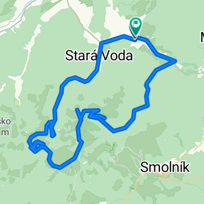
Krompachy, Lacemberská dolina, popod Bukovec, Závadka, Bindt, Teplička , Markušovce , Sp. Vlachy, Krompachy
A cycling route starting in Krompachy, Košický kraj, Slovak Republic.
Overview
About this route
Stredne náročná MTB trasa, vo Volovských vrchoch s peknými výhľadmi na Poráčsku dolinu, Galmus, Vysoké Tatry. Z dojazdom po doline Hornádu. Záver za Olcnavou asfalt do Krompách.
- -:--
- Duration
- 70.1 km
- Distance
- 770 m
- Ascent
- 772 m
- Descent
- ---
- Avg. speed
- ---
- Avg. speed
Route quality
Waytypes & surfaces along the route
Waytypes
Track
45.7 km
(65 %)
Road
14 km
(20 %)
Surfaces
Paved
5.5 km
(8 %)
Unpaved
44.3 km
(63 %)
Unpaved (undefined)
18.6 km
(27 %)
Ground
13.9 km
(20 %)
Continue with Bikemap
Use, edit, or download this cycling route
You would like to ride Krompachy, Lacemberská dolina, popod Bukovec, Závadka, Bindt, Teplička , Markušovce , Sp. Vlachy, Krompachy or customize it for your own trip? Here is what you can do with this Bikemap route:
Free features
- Save this route as favorite or in collections
- Copy & plan your own version of this route
- Sync your route with Garmin or Wahoo
Premium features
Free trial for 3 days, or one-time payment. More about Bikemap Premium.
- Navigate this route on iOS & Android
- Export a GPX / KML file of this route
- Create your custom printout (try it for free)
- Download this route for offline navigation
Discover more Premium features.
Get Bikemap PremiumFrom our community
Other popular routes starting in Krompachy
 Švedlár Zlatý stôl kanal Švedlár
- Distance
- 46.9 km
- Ascent
- 1,049 m
- Descent
- 1,051 m
- Location
- Krompachy, Košický kraj, Slovak Republic
 Spišských 333EXTREME
- Distance
- 329.5 km
- Ascent
- 3,653 m
- Descent
- 3,653 m
- Location
- Krompachy, Košický kraj, Slovak Republic
 2018 - C02 - Day 5 - Krompachy - Kosice
- Distance
- 51 km
- Ascent
- 553 m
- Descent
- 818 m
- Location
- Krompachy, Košický kraj, Slovak Republic
 16 Za panoramatickými výhľadmi
- Distance
- 55.2 km
- Ascent
- 868 m
- Descent
- 861 m
- Location
- Krompachy, Košický kraj, Slovak Republic
 2016_Wien_Lwiw_Tag03_202km_2.500hm
- Distance
- 201.4 km
- Ascent
- 1,439 m
- Descent
- 1,370 m
- Location
- Krompachy, Košický kraj, Slovak Republic
 Švedlar-Skalisko Zlatý stôl -tunel- Švedlar
- Distance
- 49.5 km
- Ascent
- 1,146 m
- Descent
- 1,143 m
- Location
- Krompachy, Košický kraj, Slovak Republic
 Around Knola
- Distance
- 84 km
- Ascent
- 1,613 m
- Descent
- 1,601 m
- Location
- Krompachy, Košický kraj, Slovak Republic
 1deň Ostrý kameň 2deň Genier......túra
- Distance
- 16.3 km
- Ascent
- 1,029 m
- Descent
- 1,029 m
- Location
- Krompachy, Košický kraj, Slovak Republic
Open it in the app