

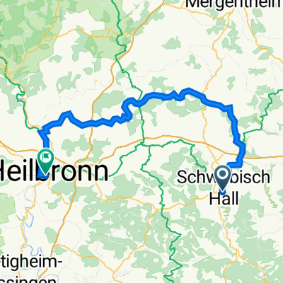
RT_75_SWH-Oberrot-Öhringen-SWH
A cycling route starting in Schwäbisch Hall, Baden-Württemberg, Germany.
Overview
About this route
- -:--
- Duration
- 76.1 km
- Distance
- 763 m
- Ascent
- 762 m
- Descent
- ---
- Avg. speed
- ---
- Avg. speed
Route quality
Waytypes & surfaces along the route
Waytypes
Track
22.7 km
(30 %)
Quiet road
21 km
(28 %)
Surfaces
Paved
56.8 km
(75 %)
Unpaved
4.9 km
(6 %)
Asphalt
51 km
(67 %)
Paved (undefined)
4.7 km
(6 %)
Continue with Bikemap
Use, edit, or download this cycling route
You would like to ride RT_75_SWH-Oberrot-Öhringen-SWH or customize it for your own trip? Here is what you can do with this Bikemap route:
Free features
- Save this route as favorite or in collections
- Copy & plan your own version of this route
- Sync your route with Garmin or Wahoo
Premium features
Free trial for 3 days, or one-time payment. More about Bikemap Premium.
- Navigate this route on iOS & Android
- Export a GPX / KML file of this route
- Create your custom printout (try it for free)
- Download this route for offline navigation
Discover more Premium features.
Get Bikemap PremiumFrom our community
Other popular routes starting in Schwäbisch Hall
 Kleine Sonntagsrunde: SHA - Cröffelbach - Otterbach - Einkorn - SHA
- Distance
- 36 km
- Ascent
- 458 m
- Descent
- 458 m
- Location
- Schwäbisch Hall, Baden-Württemberg, Germany
 Schwäbisch Hall Breiteich Trails
- Distance
- 19.7 km
- Ascent
- 553 m
- Descent
- 593 m
- Location
- Schwäbisch Hall, Baden-Württemberg, Germany
 Schwäbisch Hall - Heilbronn
- Distance
- 95 km
- Ascent
- 585 m
- Descent
- 731 m
- Location
- Schwäbisch Hall, Baden-Württemberg, Germany
 Sulzbach-Vellberg-Geislingen-Hessental
- Distance
- 46.5 km
- Ascent
- 274 m
- Descent
- 274 m
- Location
- Schwäbisch Hall, Baden-Württemberg, Germany
 SHA Markt - Lemberg - Schleifbach
- Distance
- 26.3 km
- Ascent
- 375 m
- Descent
- 397 m
- Location
- Schwäbisch Hall, Baden-Württemberg, Germany
 Haller 2-Fluesse-Tour
- Distance
- 36.8 km
- Ascent
- 328 m
- Descent
- 328 m
- Location
- Schwäbisch Hall, Baden-Württemberg, Germany
 Schwäbisch Hall Breiteich Trails
- Distance
- 19.5 km
- Ascent
- 572 m
- Descent
- 612 m
- Location
- Schwäbisch Hall, Baden-Württemberg, Germany
 SHA - Mainhardt - Sittenhardt - Westheim - Tullau - SHA
- Distance
- 51.1 km
- Ascent
- 506 m
- Descent
- 503 m
- Location
- Schwäbisch Hall, Baden-Württemberg, Germany
Open it in the app