

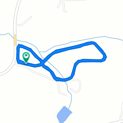
3984–4016 Whitepath Rd, Ellijay to 4018–4092 Whitepath Rd, Ellijay
A cycling route starting in Blue Ridge, Georgia, United States of America.
Overview
About this route
- 1 h 30 min
- Duration
- 27 km
- Distance
- 517 m
- Ascent
- 520 m
- Descent
- 18 km/h
- Avg. speed
- ---
- Avg. speed

Route quality
Waytypes & surfaces along the route
Waytypes
Road
13.8 km
(51 %)
Quiet road
13.2 km
(49 %)
Undefined
0 km
(<1 %)
Surfaces
Paved
20.5 km
(76 %)
Asphalt
18.8 km
(70 %)
Paved (undefined)
1.7 km
(6 %)
Undefined
6.5 km
(24 %)
Continue with Bikemap
Use, edit, or download this cycling route
You would like to ride 3984–4016 Whitepath Rd, Ellijay to 4018–4092 Whitepath Rd, Ellijay or customize it for your own trip? Here is what you can do with this Bikemap route:
Free features
- Save this route as favorite or in collections
- Copy & plan your own version of this route
- Sync your route with Garmin or Wahoo
Premium features
Free trial for 3 days, or one-time payment. More about Bikemap Premium.
- Navigate this route on iOS & Android
- Export a GPX / KML file of this route
- Create your custom printout (try it for free)
- Download this route for offline navigation
Discover more Premium features.
Get Bikemap PremiumFrom our community
Other popular routes starting in Blue Ridge
 3984–4016 Whitepath Rd, Ellijay to 4018–4092 Whitepath Rd, Ellijay
- Distance
- 27 km
- Ascent
- 517 m
- Descent
- 520 m
- Location
- Blue Ridge, Georgia, United States of America
 Day 5: Blue Ridge, GA. to Clayton, GA.
- Distance
- 104.5 km
- Ascent
- 928 m
- Descent
- 886 m
- Location
- Blue Ridge, Georgia, United States of America
 Three Forks Loop
- Distance
- 32.2 km
- Ascent
- 566 m
- Descent
- 566 m
- Location
- Blue Ridge, Georgia, United States of America
 Loving Road, Morganton to Loving Road, Morganton
- Distance
- 5.1 km
- Ascent
- 0 m
- Descent
- 7 m
- Location
- Blue Ridge, Georgia, United States of America
 459–481 W First St, Blue Ridge to E First St, Blue Ridge
- Distance
- 2.5 km
- Ascent
- 28 m
- Descent
- 37 m
- Location
- Blue Ridge, Georgia, United States of America
 ToA19 - Brasstown Bald
- Distance
- 208.1 km
- Ascent
- 3,282 m
- Descent
- 2,338 m
- Location
- Blue Ridge, Georgia, United States of America
 715–799 Campbell Camp Rd, Blue Ridge to Green Mountain, Blue Ridge
- Distance
- 4.5 km
- Ascent
- 186 m
- Descent
- 154 m
- Location
- Blue Ridge, Georgia, United States of America
 4018–4092 Whitepath Rd, Ellijay to 480 W First St, Blue Ridge
- Distance
- 16.1 km
- Ascent
- 352 m
- Descent
- 294 m
- Location
- Blue Ridge, Georgia, United States of America
Open it in the app