

Fulda-Radweg
A cycling route starting in Bad Karlshafen, Lower Saxony, Germany.
Overview
About this route
Der 260 km lange Flusswanderweg verläuft von den Höhen der Rhön in die Ebene und ist auch für ungeübte und Familien zu empfehlen.
- -:--
- Duration
- 246.4 km
- Distance
- 857 m
- Ascent
- 176 m
- Descent
- ---
- Avg. speed
- ---
- Avg. speed
Route quality
Waytypes & surfaces along the route
Waytypes
Track
77.3 km
(31 %)
Quiet road
55.5 km
(23 %)
Surfaces
Paved
230 km
(93 %)
Unpaved
9 km
(4 %)
Asphalt
211.6 km
(86 %)
Paving stones
7.1 km
(3 %)
Continue with Bikemap
Use, edit, or download this cycling route
You would like to ride Fulda-Radweg or customize it for your own trip? Here is what you can do with this Bikemap route:
Free features
- Save this route as favorite or in collections
- Copy & plan your own version of this route
- Sync your route with Garmin or Wahoo
Premium features
Free trial for 3 days, or one-time payment. More about Bikemap Premium.
- Navigate this route on iOS & Android
- Export a GPX / KML file of this route
- Create your custom printout (try it for free)
- Download this route for offline navigation
Discover more Premium features.
Get Bikemap PremiumFrom our community
Other popular routes starting in Bad Karlshafen
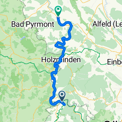
 Weserradweg 2 Bad Karlshafen-Holzminden
- Distance
- 38.7 km
- Ascent
- 182 m
- Descent
- 192 m
- Location
- Bad Karlshafen, Lower Saxony, Germany
 Bad Karlshafen - Hannoversch Münden
- Distance
- 44.5 km
- Ascent
- 214 m
- Descent
- 190 m
- Location
- Bad Karlshafen, Lower Saxony, Germany
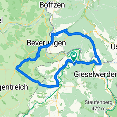
 Worthweg 5, Beverungen nach Worthweg 5, Beverungen
- Distance
- 22.2 km
- Ascent
- 370 m
- Descent
- 367 m
- Location
- Bad Karlshafen, Lower Saxony, Germany
 9KarlshafenHannMB
- Distance
- 51.1 km
- Ascent
- 338 m
- Descent
- 301 m
- Location
- Bad Karlshafen, Lower Saxony, Germany
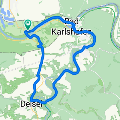
 Gipfeltour im Reinhardswald
- Distance
- 58.9 km
- Ascent
- 917 m
- Descent
- 920 m
- Location
- Bad Karlshafen, Lower Saxony, Germany
 An der Schlagd 3, Карлсхафен до An der Schlagd 3, Карлсхафен
- Distance
- 53.1 km
- Ascent
- 930 m
- Descent
- 931 m
- Location
- Bad Karlshafen, Lower Saxony, Germany
 tuor 2
- Distance
- 83.4 km
- Ascent
- 339 m
- Descent
- 370 m
- Location
- Bad Karlshafen, Lower Saxony, Germany
 Trendelburg, Jakobsberg, Derental, Bodenfelde
- Distance
- 65.7 km
- Ascent
- 788 m
- Descent
- 787 m
- Location
- Bad Karlshafen, Lower Saxony, Germany
Open it in the app