

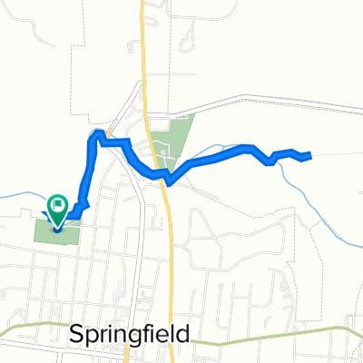
Adairsville Loop
A cycling route starting in Springfield, Tennessee, United States of America.
Overview
About this route
West Gallatin Street
Schley Rd
Barren Plains Rd
Smith Grove Church Road
US 431( South MainStreet}
- -:--
- Duration
- 12.9 km
- Distance
- 126 m
- Ascent
- 127 m
- Descent
- ---
- Avg. speed
- ---
- Avg. speed
Route quality
Waytypes & surfaces along the route
Waytypes
Quiet road
7.2 km
(56 %)
Busy road
3.3 km
(26 %)
Surfaces
Paved
0 km
(<1 %)
Concrete
0 km
(<1 %)
Undefined
12.9 km
(100 %)
Continue with Bikemap
Use, edit, or download this cycling route
You would like to ride Adairsville Loop or customize it for your own trip? Here is what you can do with this Bikemap route:
Free features
- Save this route as favorite or in collections
- Copy & plan your own version of this route
- Sync your route with Garmin or Wahoo
Premium features
Free trial for 3 days, or one-time payment. More about Bikemap Premium.
- Navigate this route on iOS & Android
- Export a GPX / KML file of this route
- Create your custom printout (try it for free)
- Download this route for offline navigation
Discover more Premium features.
Get Bikemap PremiumFrom our community
Other popular routes starting in Springfield
 2nd Avenue West 311, Springfield to 2nd Avenue West 311, Springfield
- Distance
- 5.4 km
- Ascent
- 111 m
- Descent
- 105 m
- Location
- Springfield, Tennessee, United States of America
 2nd Avenue West 311, Springfield to 2nd Avenue West 311, Springfield
- Distance
- 6.8 km
- Ascent
- 86 m
- Descent
- 84 m
- Location
- Springfield, Tennessee, United States of America
 3rd Avenue West 609, Springfield to 2nd Avenue West 311, Springfield
- Distance
- 6.7 km
- Ascent
- 77 m
- Descent
- 83 m
- Location
- Springfield, Tennessee, United States of America
 2nd Avenue West 311, Springfield to 2nd Avenue West 311, Springfield
- Distance
- 11.4 km
- Ascent
- 111 m
- Descent
- 82 m
- Location
- Springfield, Tennessee, United States of America
 Wilkes Road 4202, Springfield to Wilkes Road 4202, Springfield
- Distance
- 10.9 km
- Ascent
- 129 m
- Descent
- 81 m
- Location
- Springfield, Tennessee, United States of America
 North Main Street 11, Springfield to North Main Street 11, Springfield
- Distance
- 5.2 km
- Ascent
- 97 m
- Descent
- 65 m
- Location
- Springfield, Tennessee, United States of America
 Wilkes Road 4155, Springfield to J Porter Drive 965, Springfield
- Distance
- 1.8 km
- Ascent
- 46 m
- Descent
- 64 m
- Location
- Springfield, Tennessee, United States of America
 2nd Avenue West 311, Springfield to 2nd Avenue West 311, Springfield
- Distance
- 11.3 km
- Ascent
- 96 m
- Descent
- 57 m
- Location
- Springfield, Tennessee, United States of America
Open it in the app