

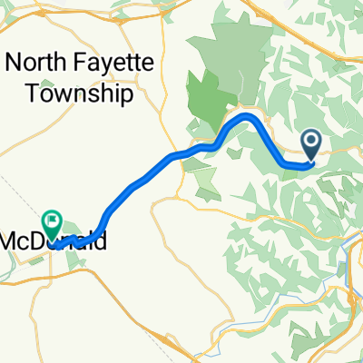
Panhandle Trail, Oakdale to 151 School St, McDonald
A cycling route starting in Rennerdale, Pennsylvania, United States of America.
Overview
About this route
- 38 min
- Duration
- 11.4 km
- Distance
- 119 m
- Ascent
- 74 m
- Descent
- 18 km/h
- Avg. speed
- ---
- Avg. speed
Route quality
Waytypes & surfaces along the route
Waytypes
Cycleway
9.7 km
(85 %)
Road
1.4 km
(12 %)
Surfaces
Paved
1.4 km
(12 %)
Unpaved
9.7 km
(85 %)
Loose gravel
9.7 km
(85 %)
Asphalt
1.4 km
(12 %)
Undefined
0.3 km
(3 %)
Continue with Bikemap
Use, edit, or download this cycling route
You would like to ride Panhandle Trail, Oakdale to 151 School St, McDonald or customize it for your own trip? Here is what you can do with this Bikemap route:
Free features
- Save this route as favorite or in collections
- Copy & plan your own version of this route
- Sync your route with Garmin or Wahoo
Premium features
Free trial for 3 days, or one-time payment. More about Bikemap Premium.
- Navigate this route on iOS & Android
- Export a GPX / KML file of this route
- Create your custom printout (try it for free)
- Download this route for offline navigation
Discover more Premium features.
Get Bikemap PremiumFrom our community
Other popular routes starting in Rennerdale
 Panhandle Trail, Oakdale to 151 School St, McDonald
- Distance
- 11.4 km
- Ascent
- 119 m
- Descent
- 74 m
- Location
- Rennerdale, Pennsylvania, United States of America
 Recording from June 21, 11:34 AM
- Distance
- 21.1 km
- Ascent
- 152 m
- Descent
- 156 m
- Location
- Rennerdale, Pennsylvania, United States of America
 unotrekstore
- Distance
- 38.3 km
- Ascent
- 356 m
- Descent
- 356 m
- Location
- Rennerdale, Pennsylvania, United States of America
 Panhandle Trail - Walker's Mill to Primrose
- Distance
- 13.9 km
- Ascent
- 100 m
- Descent
- 46 m
- Location
- Rennerdale, Pennsylvania, United States of America
 6541 Steubenville Pike, Pittsburgh to 285 Orchard Spring Rd, Pittsburgh
- Distance
- 12.5 km
- Ascent
- 165 m
- Descent
- 204 m
- Location
- Rennerdale, Pennsylvania, United States of America
 Elm Avenue 13, Carnegie to Columbia Avenue 32, Carnegie
- Distance
- 14.6 km
- Ascent
- 140 m
- Descent
- 137 m
- Location
- Rennerdale, Pennsylvania, United States of America
 120 Tuscany Ridge Dr, Oakdale to 154–160 Baldwin Rd, Carnegie
- Distance
- 6.4 km
- Ascent
- 60 m
- Descent
- 100 m
- Location
- Rennerdale, Pennsylvania, United States of America
 Recording from May 6, 6:22 PM
- Distance
- 18 km
- Ascent
- 130 m
- Descent
- 143 m
- Location
- Rennerdale, Pennsylvania, United States of America
Open it in the app