
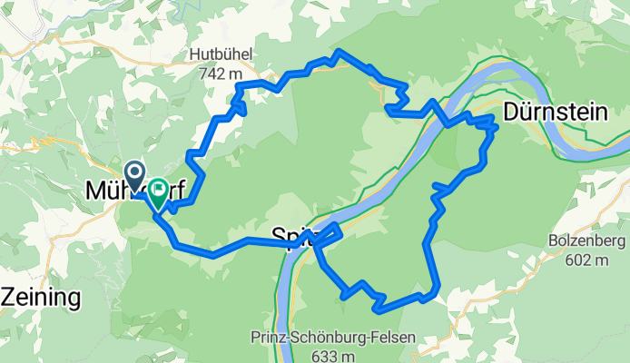
MTB Runde Wachau links/rechts
A cycling route starting in Mühldorf, Lower Austria, Austria.
Overview
About this route
eine schöne MTB Tour in der Wachau, links u rechts der Donau. Von Mühldorf rauf zu den Bärenwänden, auf schönen Trails weiter u runter nach Weißenkirchen, dort Fähre zun Südufer. Rauf in den Dunkelsteinerwald, lohnenswerter Abstecher zum Seekopf, dann gehts flacher weiter und letztlich steil runte im Buchental. Wieder mit der Fähre rüber nach Spitz, auf B217 (Variante Birnweg) zurück zum Start. Befahren auf eigenes Risiko!
- -:--
- Duration
- 45.3 km
- Distance
- 1,238 m
- Ascent
- 1,261 m
- Descent
- ---
- Avg. speed
- ---
- Avg. speed

Continue with Bikemap
Use, edit, or download this cycling route
You would like to ride MTB Runde Wachau links/rechts or customize it for your own trip? Here is what you can do with this Bikemap route:
Free features
- Save this route as favorite or in collections
- Copy & plan your own version of this route
- Sync your route with Garmin or Wahoo
Premium features
Free trial for 3 days, or one-time payment. More about Bikemap Premium.
- Navigate this route on iOS & Android
- Export a GPX / KML file of this route
- Create your custom printout (try it for free)
- Download this route for offline navigation
Discover more Premium features.
Get Bikemap PremiumFrom our community
Other popular routes starting in Mühldorf
 Weinsteintour
- Distance
- 38.2 km
- Ascent
- 1,741 m
- Descent
- 1,741 m
- Location
- Mühldorf, Lower Austria, Austria
 Rennrad Mühldorf MariaLankowitz
- Distance
- 254.3 km
- Ascent
- 1,971 m
- Descent
- 1,834 m
- Location
- Mühldorf, Lower Austria, Austria
 MTB Mühldorf Nebelstein
- Distance
- 83.3 km
- Ascent
- 1,502 m
- Descent
- 860 m
- Location
- Mühldorf, Lower Austria, Austria
 Kombitour 14 & 20
- Distance
- 37.5 km
- Ascent
- 1,101 m
- Descent
- 1,103 m
- Location
- Mühldorf, Lower Austria, Austria
 Rennrad Mühldorf MariaLankowitz
- Distance
- 254 km
- Ascent
- 1,971 m
- Descent
- 1,834 m
- Location
- Mühldorf, Lower Austria, Austria
 Heimliches Gericht
- Distance
- 58.5 km
- Ascent
- 1,294 m
- Descent
- 1,290 m
- Location
- Mühldorf, Lower Austria, Austria
 RR Mühldorf-Bärnkopf-Grein
- Distance
- 128.2 km
- Ascent
- 1,098 m
- Descent
- 1,098 m
- Location
- Mühldorf, Lower Austria, Austria
 MTB Mühldorf-Mariazell Grenzsuche
- Distance
- 122.4 km
- Ascent
- 2,915 m
- Descent
- 2,431 m
- Location
- Mühldorf, Lower Austria, Austria
Open it in the app