

Templin - Stadtsee
A cycling route starting in Templin, Brandenburg, Germany.
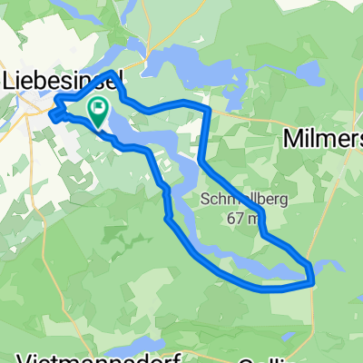
Overview
About this route
<span style="font-size: small;"><font color="#000000"><font face="Times New Roman">Die Tour um den Stadtsee Templin beginnt und endet am Bahnhof Templin-Stadt. Bis zum Fährkrug ist der Radweg ausgebaut und asphaltiert. Nach einem Kilometer kommt man zum Stadtbad Templin, wo die Möglichkeit zum Baden besteht. In unmittelbarer Nachbarschaft befindet sich die Gaststätte „Kleine Seglerresidenz“. Nach 4 km hat man den Bruchsee am Fährkrug erreicht. Hier gibt es eine überdachte Sitzmöglichkeit, die man auch zum Picknick nutzen kann. Außerdem besteht im Bruchsee die Möglichkeit zum Baden. Von hier aus muss man auf der Hauptstraße Richtung Boitzenburg weiterfahren. Nach ca. 700 m hat man den Bahnübergang erreicht, wo man links auf einen festen Sandweg abbiegt, der gut befahrbar ist. Nach insgesamt 5,6 km hat man die Gleuenseebrücke erreicht. Auch hier gibt es eine überdachte Sitzmöglichkeit. Wer möchte, kann von hier aus den Sechs-Seen-Rundweg bewandern.</font></font></span>
<span style="font-size: small;"><font color="#000000"><font face="Times New Roman">Wer den Stadtsee weiter umrunden möchte, fährt den Uferweg entlang. Das ist anfangs ein sehr schmaler Pfad, der später breiter wird, aber sehr wurzelig ist. Mehrere Bänke entlang des Uferweges laden zum Verweilen ein. Nach ca. 9 km hat man den Kaffeegarten „Seeblick“ erreicht. Von hier aus hat man einen schönen Blick über den See und auf das Stadtbad. In unmittelbarer Nähe (ca. 300 m) befindet sich die Badestelle „Schinderkuhle“. Die Garteneisenbahn nach weiteren 300 m ist besonders für Kinder ein Anziehungspunkt. Nach 10 km endet der Uferweg und man kommt auf eine asphaltierte Straße die zur Pionierbrücke führt. Nach 10,6 km erreicht man die<span style="mso-spacerun: yes;"> </span>Dampferanlegestelle und den Stadthafen Templin, wo die Möglichkeit zur Bootsausleihe besteht. Auf der gegenüberliegenden Seite befindet sich die Gaststätte „Shanty“. Auch von hier aus hat man einen schönen Blick auf den See.</font></font></span>
<span style="font-size: small;"><font color="#000000"><font face="Times New Roman">Nach 11,5 km hat man wieder den Ausgangspunkt – Bahnhof Templin Stadt – erreicht.</font></font></span>
- -:--
- Duration
- 10.9 km
- Distance
- 103 m
- Ascent
- 105 m
- Descent
- ---
- Avg. speed
- ---
- Avg. speed
Continue with Bikemap
Use, edit, or download this cycling route
You would like to ride Templin - Stadtsee or customize it for your own trip? Here is what you can do with this Bikemap route:
Free features
- Save this route as favorite or in collections
- Copy & plan your own version of this route
- Sync your route with Garmin or Wahoo
Premium features
Free trial for 3 days, or one-time payment. More about Bikemap Premium.
- Navigate this route on iOS & Android
- Export a GPX / KML file of this route
- Create your custom printout (try it for free)
- Download this route for offline navigation
Discover more Premium features.
Get Bikemap PremiumFrom our community
Other popular routes starting in Templin
 Tour 2020 - Tag 1
- Distance
- 100 km
- Ascent
- 126 m
- Descent
- 150 m
- Location
- Templin, Brandenburg, Germany
 Kurze Alleentour
- Distance
- 23.5 km
- Ascent
- 72 m
- Descent
- 73 m
- Location
- Templin, Brandenburg, Germany
 Templin-Boitzenburg-Prenzlau
- Distance
- 41.6 km
- Ascent
- 183 m
- Descent
- 209 m
- Location
- Templin, Brandenburg, Germany
 Über Stock und Stein (kurz)
- Distance
- 29.3 km
- Ascent
- 127 m
- Descent
- 125 m
- Location
- Templin, Brandenburg, Germany
 Templiner See
- Distance
- 19.7 km
- Ascent
- 280 m
- Descent
- 283 m
- Location
- Templin, Brandenburg, Germany
 Um den Lübbesee (2)
- Distance
- 23.1 km
- Ascent
- 154 m
- Descent
- 150 m
- Location
- Templin, Brandenburg, Germany
 63 Km Templin
- Distance
- 62.6 km
- Ascent
- 187 m
- Descent
- 187 m
- Location
- Templin, Brandenburg, Germany
 53 km Templin
- Distance
- 57.9 km
- Ascent
- 167 m
- Descent
- 169 m
- Location
- Templin, Brandenburg, Germany
Open it in the app