Premium Badge Download on the App Store Get it on Google Play Turn-by-turn Navigation Offline Maps Bike Type Optimized Routing Premium Maps Custom Bike Computer Export Routes Route Previews Fall Detection Premium Support

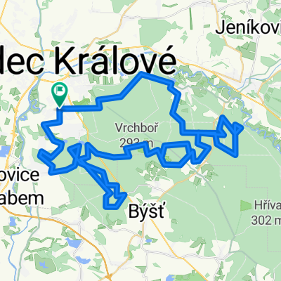
Cycling Route in Hradec Králové, Královéhradecký kraj, Czechia

MTB - HK - Čermná n_O a zpět

0
Open this route in the Bikemap app

Open this route in the Bikemap app

Open this route in Bikemap Web

Open this route in Bikemap Web

64 km
Distance
335 m
Ascent
335 m
Descent
-:-- h
Duration
-- km/h
Avg. Speed
--- m
Max. Elevation

About This Route

64 km, nastoupáno 720 m, 4, hod. a 50 min., začátek i konec Hradec Králové - Moravské předměstí,  cesta  vede téměř celá  lesem, po lesních cestách a pěšinách,  krátké přejezdy po zpevněných cestách,   místy jsou i náročnější  úseky.

Cestou tam je možné využít občerstvení v hospodě  v Hoděšovicích a  ve Vysokém Chvojně,  otočka je v Čermné nad Orlicí,  část Malá Čermná, hospoda u hřiště,  cesta  zpět, občetrstvení je  možné  až  v novohradeckých lesích   v  bufetu  Mazury.

This cycling route is ideal for: MTB

You will cycle on the following surfaces: Unpaved Gravel

Customize this cycling route with the Bikemap route planner.

Make it yours!

Did you know? You can use this route as a template in our cycling route planner if you don't wish to start from scratch. Customize it based on your needs to plan your perfect cycling tour.

Open it in the app