

Appeltal Autofrei von Imsbach aus
A cycling route starting in Imsbach, Rhineland-Palatinate, Germany.
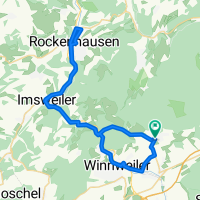
Overview
About this route
Sehr schöne Strecke durch das Appeltal. Größtenteils flaches abgelegenes Tal mit wunderschöner Landschaft.
Einzige Schwierigkeit ist eine Steigung von ca. 4-5 km von Rockenhausen Richtung Würzweiler ins eigentliche Appeltal.
Den Autofreien Famillentag kann ich nur empfehlen, das Tal ist ziemlich abgelegen, der Tag aber sehr gut besucht und die Beteilligung in den Gemeinden an der Strecke wirklich superb.
- -:--
- Duration
- 66.7 km
- Distance
- 589 m
- Ascent
- 633 m
- Descent
- ---
- Avg. speed
- 331 m
- Avg. speed
Route quality
Waytypes & surfaces along the route
Waytypes
Busy road
54.4 km
(82 %)
Quiet road
8.1 km
(12 %)
Surfaces
Paved
59 km
(88 %)
Asphalt
58.6 km
(88 %)
Paved (undefined)
0.3 km
(<1 %)
Undefined
7.7 km
(12 %)
Continue with Bikemap
Use, edit, or download this cycling route
You would like to ride Appeltal Autofrei von Imsbach aus or customize it for your own trip? Here is what you can do with this Bikemap route:
Free features
- Save this route as favorite or in collections
- Copy & plan your own version of this route
- Sync your route with Garmin or Wahoo
Premium features
Free trial for 3 days, or one-time payment. More about Bikemap Premium.
- Navigate this route on iOS & Android
- Export a GPX / KML file of this route
- Create your custom printout (try it for free)
- Download this route for offline navigation
Discover more Premium features.
Get Bikemap PremiumFrom our community
Other popular routes starting in Imsbach
 TuS holt Bar le Duc ab
- Distance
- 72.6 km
- Ascent
- 151 m
- Descent
- 301 m
- Location
- Imsbach, Rhineland-Palatinate, Germany
 46_Kupferweg
- Distance
- 7.8 km
- Ascent
- 391 m
- Descent
- 390 m
- Location
- Imsbach, Rhineland-Palatinate, Germany
 Imsbach KL Rundtour
- Distance
- 55 km
- Ascent
- 481 m
- Descent
- 492 m
- Location
- Imsbach, Rhineland-Palatinate, Germany
 Von Imsbach auf den Donnersberg
- Distance
- 26 km
- Ascent
- 879 m
- Descent
- 879 m
- Location
- Imsbach, Rhineland-Palatinate, Germany
 DONNERSBERG FALKENSTEIN.gpx
- Distance
- 17.8 km
- Ascent
- 610 m
- Descent
- 612 m
- Location
- Imsbach, Rhineland-Palatinate, Germany
 Imsbach Rockenhausen Winnweiler
- Distance
- 28.2 km
- Ascent
- 422 m
- Descent
- 434 m
- Location
- Imsbach, Rhineland-Palatinate, Germany
 Imsbach KL Rundtour Via Schallodenbach und Enkenbach
- Distance
- 56.5 km
- Ascent
- 613 m
- Descent
- 619 m
- Location
- Imsbach, Rhineland-Palatinate, Germany
 Einfach nur steil
- Distance
- 9.6 km
- Ascent
- 330 m
- Descent
- 248 m
- Location
- Imsbach, Rhineland-Palatinate, Germany
Open it in the app