

Allgäu-das stille Allgäu
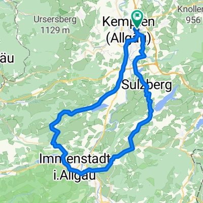
A cycling route starting in Kempten (Allgäu), Bavaria, Germany.
Overview
About this route
Die Radtour verknüpft Allgäuer Wiesen- und Weidelandschaft, Bergtäler und Höhenzüge. Anspruchsvoll, aber lohnenswert, erkundet man doch spannende Regionen abseits großer touristischer Zentren. (Tourbeschreibung unter: thod:er@gmx.de)
- -:--
- Duration
- 74.3 km
- Distance
- 3,190 m
- Ascent
- 3,190 m
- Descent
- ---
- Avg. speed
- 1,049 m
- Avg. speed
Route quality
Waytypes & surfaces along the route
Waytypes
Path
31.6 km
(43 %)
Road
18.5 km
(25 %)
Surfaces
Paved
50.3 km
(68 %)
Unpaved
21.5 km
(29 %)
Asphalt
49 km
(66 %)
Gravel
17.5 km
(24 %)
Continue with Bikemap
Use, edit, or download this cycling route
You would like to ride Allgäu-das stille Allgäu or customize it for your own trip? Here is what you can do with this Bikemap route:
Free features
- Save this route as favorite or in collections
- Copy & plan your own version of this route
- Sync your route with Garmin or Wahoo
Premium features
Free trial for 3 days, or one-time payment. More about Bikemap Premium.
- Navigate this route on iOS & Android
- Export a GPX / KML file of this route
- Create your custom printout (try it for free)
- Download this route for offline navigation
Discover more Premium features.
Get Bikemap PremiumFrom our community
Other popular routes starting in Kempten (Allgäu)
 schnelle Durach - Rottachspeicher - Martinszell Runde
- Distance
- 39.6 km
- Ascent
- 399 m
- Descent
- 404 m
- Location
- Kempten (Allgäu), Bavaria, Germany
 diepolz rettenberg
- Distance
- 62.6 km
- Ascent
- 689 m
- Descent
- 690 m
- Location
- Kempten (Allgäu), Bavaria, Germany
 Kempten-Oberstdorf
- Distance
- 50.8 km
- Ascent
- 460 m
- Descent
- 338 m
- Location
- Kempten (Allgäu), Bavaria, Germany
 Trainingsrunde
- Distance
- 41.5 km
- Ascent
- 750 m
- Descent
- 754 m
- Location
- Kempten (Allgäu), Bavaria, Germany
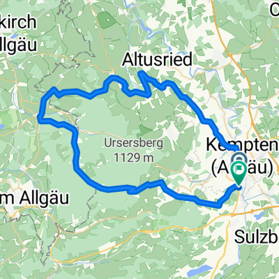 Nord-West Runde Kempten
- Distance
- 59.3 km
- Ascent
- 656 m
- Descent
- 664 m
- Location
- Kempten (Allgäu), Bavaria, Germany
 Kempten-Jochpaß-Grän-Pfronten-Kempten
- Distance
- 106.7 km
- Ascent
- 1,185 m
- Descent
- 1,070 m
- Location
- Kempten (Allgäu), Bavaria, Germany
 Sonntags-Katertour
- Distance
- 53.7 km
- Ascent
- 1,107 m
- Descent
- 1,107 m
- Location
- Kempten (Allgäu), Bavaria, Germany
 Von Kempten über Hauchenberg Niedersonthofen nach Kempten
- Distance
- 55.8 km
- Ascent
- 882 m
- Descent
- 872 m
- Location
- Kempten (Allgäu), Bavaria, Germany
Open it in the app