

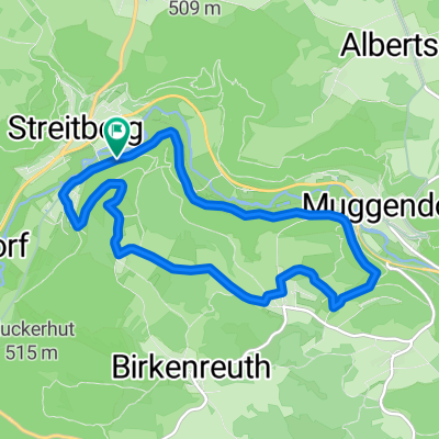
D_BY_Muggenhof-Oswaldhöhle-Doktorshöhle-Wiesenttal-Doos-Riesenburg-Quackenschloß-Mehlbeerensteig_RR-13km-380hm
A cycling route starting in Unterleinleiter, Bavaria, Germany.
Overview
About this route
- -:--
- Duration
- 13 km
- Distance
- 405 m
- Ascent
- 413 m
- Descent
- ---
- Avg. speed
- ---
- Avg. speed

Route quality
Waytypes & surfaces along the route
Waytypes
Track
8.4 km
(65 %)
Path
3.6 km
(28 %)
Surfaces
Paved
0.7 km
(5 %)
Unpaved
10.5 km
(81 %)
Unpaved (undefined)
4 km
(30 %)
Ground
3.8 km
(29 %)
Continue with Bikemap
Use, edit, or download this cycling route
You would like to ride D_BY_Muggenhof-Oswaldhöhle-Doktorshöhle-Wiesenttal-Doos-Riesenburg-Quackenschloß-Mehlbeerensteig_RR-13km-380hm or customize it for your own trip? Here is what you can do with this Bikemap route:
Free features
- Save this route as favorite or in collections
- Copy & plan your own version of this route
- Sync your route with Garmin or Wahoo
Premium features
Free trial for 3 days, or one-time payment. More about Bikemap Premium.
- Navigate this route on iOS & Android
- Export a GPX / KML file of this route
- Create your custom printout (try it for free)
- Download this route for offline navigation
Discover more Premium features.
Get Bikemap PremiumFrom our community
Other popular routes starting in Unterleinleiter
 Niederfellendorf_Behringersmühle_Pfaffenstein_Quackenschloß_Adlerstein_Riesenburg_und zurück
- Distance
- 35.1 km
- Ascent
- 625 m
- Descent
- 625 m
- Location
- Unterleinleiter, Bavaria, Germany
 2017_06 MTB: Zuckerhut
- Distance
- 28.7 km
- Ascent
- 549 m
- Descent
- 548 m
- Location
- Unterleinleiter, Bavaria, Germany
 2. Tag
- Distance
- 49.1 km
- Ascent
- 588 m
- Descent
- 588 m
- Location
- Unterleinleiter, Bavaria, Germany
 Ausfahrt durch Wiesenttal
- Distance
- 25.6 km
- Ascent
- 551 m
- Descent
- 549 m
- Location
- Unterleinleiter, Bavaria, Germany
 Rund um Muggendorf
- Distance
- 36.5 km
- Ascent
- 569 m
- Descent
- 569 m
- Location
- Unterleinleiter, Bavaria, Germany
 Rund um die Neideck
- Distance
- 9.4 km
- Ascent
- 445 m
- Descent
- 445 m
- Location
- Unterleinleiter, Bavaria, Germany
 Veilbronn_LeidingshoferTal_Streitburg_Totenstein
- Distance
- 14.8 km
- Ascent
- 471 m
- Descent
- 471 m
- Location
- Unterleinleiter, Bavaria, Germany
 AX Runde
- Distance
- 41.8 km
- Ascent
- 796 m
- Descent
- 796 m
- Location
- Unterleinleiter, Bavaria, Germany
Open it in the app