
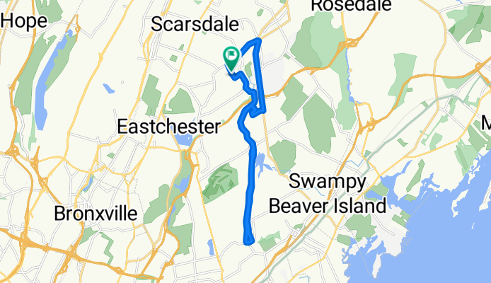
77 Top O The Ridge Dr, New Rochelle to 77 Top O The Ridge Dr, New Rochelle
A cycling route starting in Scarsdale, New York, United States of America.
Overview
About this route
- 45 min
- Duration
- 14.6 km
- Distance
- 179 m
- Ascent
- 174 m
- Descent
- 19.5 km/h
- Avg. speed
- ---
- Avg. speed
Route quality
Waytypes & surfaces along the route
Waytypes
Road
12.2 km
(83 %)
Quiet road
1.3 km
(9 %)
Surfaces
Undefined
14.6 km
(100 %)
Continue with Bikemap
Use, edit, or download this cycling route
You would like to ride 77 Top O The Ridge Dr, New Rochelle to 77 Top O The Ridge Dr, New Rochelle or customize it for your own trip? Here is what you can do with this Bikemap route:
Free features
- Save this route as favorite or in collections
- Copy & plan your own version of this route
- Sync your route with Garmin or Wahoo
Premium features
Free trial for 3 days, or one-time payment. More about Bikemap Premium.
- Navigate this route on iOS & Android
- Export a GPX / KML file of this route
- Create your custom printout (try it for free)
- Download this route for offline navigation
Discover more Premium features.
Get Bikemap PremiumFrom our community
Other popular routes starting in Scarsdale
 104 Ridgeway, White Plains to 10 Pilgrim Rd, White Plains
- Distance
- 7.7 km
- Ascent
- 79 m
- Descent
- 76 m
- Location
- Scarsdale, New York, United States of America
 77 Top O The Ridge Dr, New Rochelle to 77 Top O The Ridge Dr, New Rochelle
- Distance
- 14.6 km
- Ascent
- 179 m
- Descent
- 174 m
- Location
- Scarsdale, New York, United States of America
 110 Secor Rd, Scarsdale to 432 S Lexington Ave, White Plains
- Distance
- 12.1 km
- Ascent
- 145 m
- Descent
- 135 m
- Location
- Scarsdale, New York, United States of America
 280–286 Old Mamaroneck Rd, White Plains to Park Dr E, Valhalla
- Distance
- 8.8 km
- Ascent
- 81 m
- Descent
- 81 m
- Location
- Scarsdale, New York, United States of America
 Airport loop from Scarsdale
- Distance
- 32.9 km
- Ascent
- 473 m
- Descent
- 471 m
- Location
- Scarsdale, New York, United States of America
 Hunting Ridge Road 10, White Plains to Hunting Ridge Road 10, White Plains
- Distance
- 21.2 km
- Ascent
- 200 m
- Descent
- 199 m
- Location
- Scarsdale, New York, United States of America
 Neighborhood Loop
- Distance
- 7.2 km
- Ascent
- 38 m
- Descent
- 39 m
- Location
- Scarsdale, New York, United States of America
 54 Rutledge Rd, New Rochelle to 54 Rutledge Rd, New Rochelle
- Distance
- 10.8 km
- Ascent
- 65 m
- Descent
- 63 m
- Location
- Scarsdale, New York, United States of America