

Schöne Südtühringen Runde
A cycling route starting in Themar, Free State of Thuringia, Germany.
Overview
About this route
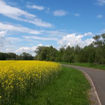
Start ist in Themar(98660). Man kann mit dem Auto anreisen (Parken auf dem TEGUT-Parkplatz) oder mit der Bahn (Tour beginnt und endet in der Nähe vom Bahnhof).Die Tour enthält ca. 20% Asphaltstrecke und der Rest sind breite Schotter- und Waldwege. Das erste Waldstück ist die Auffahrt zum Feldstein. Sie ist etwas anspruchvoller,sollte aber für jeden halbwegs trainierten Biker zu schaffen sein. Danach schliesst sich ein gleichmäßiges Mittelgebirgs Auf und Ab an. Nach 2/3 der Tour gelangt man nach Schleusingen.
- -:--
- Duration
- 32.7 km
- Distance
- 624 m
- Ascent
- 621 m
- Descent
- ---
- Avg. speed
- ---
- Avg. speed

Route highlights
Points of interest along the route
Point of interest after 24.5 km
Singletrail mit Wasserdurchfahrt, anschliesend über die Wiese
Point of interest after 29.4 km
Singletrail über die Wiese
Continue with Bikemap
Use, edit, or download this cycling route
You would like to ride Schöne Südtühringen Runde or customize it for your own trip? Here is what you can do with this Bikemap route:
Free features
- Save this route as favorite or in collections
- Copy & plan your own version of this route
- Sync your route with Garmin or Wahoo
Premium features
Free trial for 3 days, or one-time payment. More about Bikemap Premium.
- Navigate this route on iOS & Android
- Export a GPX / KML file of this route
- Create your custom printout (try it for free)
- Download this route for offline navigation
Discover more Premium features.
Get Bikemap PremiumFrom our community
Other popular routes starting in Themar
 Schöne Südtühringen Runde
- Distance
- 32.7 km
- Ascent
- 624 m
- Descent
- 621 m
- Location
- Themar, Free State of Thuringia, Germany
 Themar - Bad Salzungen
- Distance
- 63.9 km
- Ascent
- 302 m
- Descent
- 390 m
- Location
- Themar, Free State of Thuringia, Germany
 20140725_125645.gpx
- Distance
- 44.2 km
- Ascent
- 394 m
- Descent
- 476 m
- Location
- Themar, Free State of Thuringia, Germany
 Themar-HBN-Sachsenbrunn-Schleu-Themar
- Distance
- 80.2 km
- Ascent
- 561 m
- Descent
- 503 m
- Location
- Themar, Free State of Thuringia, Germany
 Werratal Etappe2
- Distance
- 87.8 km
- Ascent
- 273 m
- Descent
- 362 m
- Location
- Themar, Free State of Thuringia, Germany
 Themar-Werraquelle-Themar
- Distance
- 100.4 km
- Ascent
- 758 m
- Descent
- 758 m
- Location
- Themar, Free State of Thuringia, Germany
 Themar-Hochrhön-Kreuzberg-Themar
- Distance
- 174.4 km
- Ascent
- 2,103 m
- Descent
- 2,101 m
- Location
- Themar, Free State of Thuringia, Germany
 20160913_114532.gpx
- Distance
- 61.4 km
- Ascent
- 174 m
- Descent
- 264 m
- Location
- Themar, Free State of Thuringia, Germany
Open it in the app