
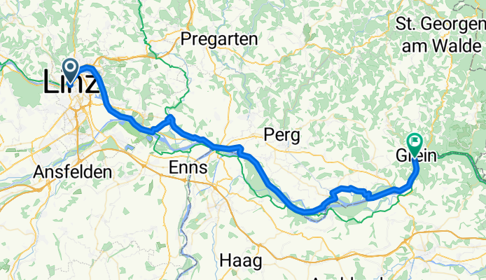
Donau-Radweg: Linz - Grein/Ardagger/Wallsee
A cycling route starting in Linz, Upper Austria, Austria.
Overview
About this route
Linz verabschiedet sich mit einem Hauch von Industrieromantik. Es geht weiter durch das kulturgeschichtlich bedeutsame Machland, wo mit Enns die älteste Ansiedlung Österreichs gelegen ist. Ein Abstecher in das Barockstift von St. Florian ist sehr lohnenswert. Aber auch ein Relikt aus einem der dunkelsten Kapitel der Geschichte ist hier mit dem KZ Mauthausen zu finden. Landschaftlich hat die Donau zwischen Machland und Strudengau eine Menge zu bieten: so wird man im sagenumwobenen Strudengau erwartet, eine Engstelle der Donau, die wegen ihrer Strudel von den Donauschiffern einst gefürchtet wurde. Dann folgt das malerische Grein, das ein schönes Motiv für Urlaubsfotos darstellt.
- -:--
- Duration
- 61.2 km
- Distance
- 38 m
- Ascent
- 60 m
- Descent
- ---
- Avg. speed
- 265 m
- Avg. speed
Route quality
Waytypes & surfaces along the route
Waytypes
Cycleway
16.6 km
(27 %)
Quiet road
15.7 km
(26 %)
Surfaces
Paved
47.6 km
(78 %)
Unpaved
4.2 km
(7 %)
Asphalt
46.6 km
(76 %)
Gravel
2 km
(3 %)
Continue with Bikemap
Use, edit, or download this cycling route
You would like to ride Donau-Radweg: Linz - Grein/Ardagger/Wallsee or customize it for your own trip? Here is what you can do with this Bikemap route:
Free features
- Save this route as favorite or in collections
- Copy & plan your own version of this route
- Sync your route with Garmin or Wahoo
Premium features
Free trial for 3 days, or one-time payment. More about Bikemap Premium.
- Navigate this route on iOS & Android
- Export a GPX / KML file of this route
- Create your custom printout (try it for free)
- Download this route for offline navigation
Discover more Premium features.
Get Bikemap PremiumFrom our community
Other popular routes starting in Linz
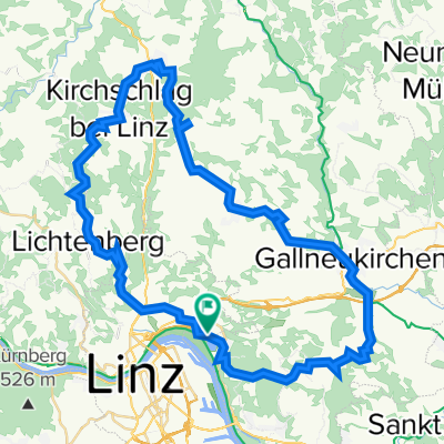
 Pfenningberg Tour
- Distance
- 28.9 km
- Ascent
- 458 m
- Descent
- 458 m
- Location
- Linz, Upper Austria, Austria
 Pferdeeisenbahn-Innertreffling-Forst-Pulgarn-Steyregg-Pfenningberg-Plesching
- Distance
- 42.8 km
- Ascent
- 674 m
- Descent
- 677 m
- Location
- Linz, Upper Austria, Austria
 Steyregg Runde
- Distance
- 22 km
- Ascent
- 218 m
- Descent
- 220 m
- Location
- Linz, Upper Austria, Austria
 Trail Pfenningbergrunde
- Distance
- 13.9 km
- Ascent
- 348 m
- Descent
- 350 m
- Location
- Linz, Upper Austria, Austria
 Oberbairing-Altenberg-Galli-Linz
- Distance
- 27.8 km
- Ascent
- 496 m
- Descent
- 496 m
- Location
- Linz, Upper Austria, Austria
 Giselawarte - GIS
- Distance
- 27.7 km
- Ascent
- 914 m
- Descent
- 834 m
- Location
- Linz, Upper Austria, Austria
 plesching
- Distance
- 32.6 km
- Ascent
- 325 m
- Descent
- 326 m
- Location
- Linz, Upper Austria, Austria
 Lichtenberg, Mirellental, Pfenningberg CLONED FROM ROUTE 38001
- Distance
- 54.3 km
- Ascent
- 1,090 m
- Descent
- 1,093 m
- Location
- Linz, Upper Austria, Austria
Open it in the app