

Pälzer Keschdeweg (Genusstour)
A cycling route starting in Gleisweiler, Rhineland-Palatinate, Germany.
Overview
About this route
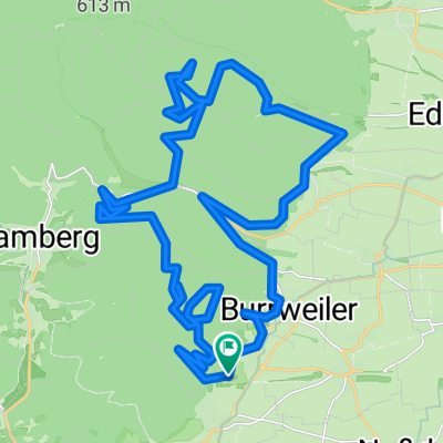
Diese Variante des Pälzer Keschdewegs kombiniert eine Weinbergserkundung mit einer Wanderung entlang des Haardtrandes im Pfälzerwald und der Romantik zweier malerischer Ortschaften. Vorbei an zwei bewirtschafteten Hütten mit jeweils großartiger Aussicht auf die Rheinebene, der St. Annakapelle und zwei Landrestaurants führt dieser Rundweg zu den schönsten Seiten der Pfälzischen Kultur.
- -:--
- Duration
- 10.8 km
- Distance
- 445 m
- Ascent
- 445 m
- Descent
- ---
- Avg. speed
- ---
- Avg. speed

Continue with Bikemap
Use, edit, or download this cycling route
You would like to ride Pälzer Keschdeweg (Genusstour) or customize it for your own trip? Here is what you can do with this Bikemap route:
Free features
- Save this route as favorite or in collections
- Copy & plan your own version of this route
- Sync your route with Garmin or Wahoo
Premium features
Free trial for 3 days, or one-time payment. More about Bikemap Premium.
- Navigate this route on iOS & Android
- Export a GPX / KML file of this route
- Create your custom printout (try it for free)
- Download this route for offline navigation
Discover more Premium features.
Get Bikemap PremiumFrom our community
Other popular routes starting in Gleisweiler
 Erlebnistag
- Distance
- 28.8 km
- Ascent
- 143 m
- Descent
- 183 m
- Location
- Gleisweiler, Rhineland-Palatinate, Germany
 Gleisweiler - Eichhörnchenweg
- Distance
- 10.6 km
- Ascent
- 311 m
- Descent
- 302 m
- Location
- Gleisweiler, Rhineland-Palatinate, Germany
 Lindenallee 6–46, Gleisweiler nach Hainbachtalstraße, Gleisweiler
- Distance
- 36.3 km
- Ascent
- 1,411 m
- Descent
- 1,417 m
- Location
- Gleisweiler, Rhineland-Palatinate, Germany
 Rund um den Hainbach
- Distance
- 9 km
- Ascent
- 279 m
- Descent
- 281 m
- Location
- Gleisweiler, Rhineland-Palatinate, Germany
 Pfalz
Pfalz- Distance
- 14.8 km
- Ascent
- 499 m
- Descent
- 474 m
- Location
- Gleisweiler, Rhineland-Palatinate, Germany
 RP_Ramberg_Kalmit
- Distance
- 53.7 km
- Ascent
- 936 m
- Descent
- 939 m
- Location
- Gleisweiler, Rhineland-Palatinate, Germany
 Kronstraße 6, Gleisweiler nach Hauptstraße 48, Neustadt an der Weinstraße
- Distance
- 18.4 km
- Ascent
- 157 m
- Descent
- 293 m
- Location
- Gleisweiler, Rhineland-Palatinate, Germany
 Recovered Route
- Distance
- 7.5 km
- Ascent
- 213 m
- Descent
- 139 m
- Location
- Gleisweiler, Rhineland-Palatinate, Germany
Open it in the app