

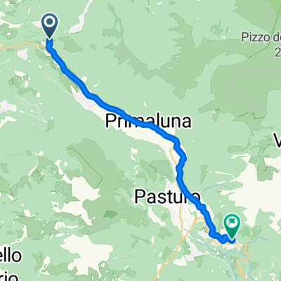
Alpe Paglio
A cycling route starting in Taceno, Lombardy, Italy.
Overview
About this route
Hard climb, expecially last 4 Km
Salita impegnavita, specialmente gli ultimi 4 km
- -:--
- Duration
- 11.2 km
- Distance
- 879 m
- Ascent
- 0 m
- Descent
- ---
- Avg. speed
- 1,314 m
- Avg. speed

Continue with Bikemap
Use, edit, or download this cycling route
You would like to ride Alpe Paglio or customize it for your own trip? Here is what you can do with this Bikemap route:
Free features
- Save this route as favorite or in collections
- Copy & plan your own version of this route
- Sync your route with Garmin or Wahoo
Premium features
Free trial for 3 days, or one-time payment. More about Bikemap Premium.
- Navigate this route on iOS & Android
- Export a GPX / KML file of this route
- Create your custom printout (try it for free)
- Download this route for offline navigation
Discover more Premium features.
Get Bikemap PremiumFrom our community
Other popular routes starting in Taceno
 como 1
- Distance
- 18.6 km
- Ascent
- 300 m
- Descent
- 60 m
- Location
- Taceno, Lombardy, Italy
 part 2
- Distance
- 17 km
- Ascent
- 571 m
- Descent
- 197 m
- Location
- Taceno, Lombardy, Italy
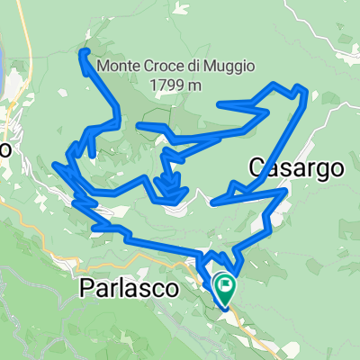 Alpe Giumello
- Distance
- 45.6 km
- Ascent
- 2,561 m
- Descent
- 2,561 m
- Location
- Taceno, Lombardy, Italy
 Taceno - Rifugio Santa Rita (via Pian delle Betulle)
- Distance
- 16.6 km
- Ascent
- 1,767 m
- Descent
- 242 m
- Location
- Taceno, Lombardy, Italy
 Pian delle Betulle
- Distance
- 13.8 km
- Ascent
- 1,073 m
- Descent
- 101 m
- Location
- Taceno, Lombardy, Italy
 Introbio da Taceno
- Distance
- 8.1 km
- Ascent
- 159 m
- Descent
- 5 m
- Location
- Taceno, Lombardy, Italy
 Alpe Paglio
- Distance
- 11.2 km
- Ascent
- 879 m
- Descent
- 0 m
- Location
- Taceno, Lombardy, Italy
 bike tour from Tartavalle Terme to Barzio
- Distance
- 14.3 km
- Ascent
- 200 m
- Descent
- 21 m
- Location
- Taceno, Lombardy, Italy
Open it in the app