
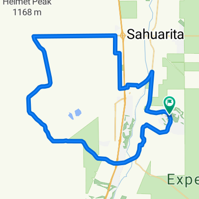
QuailCreek-Tubac-return
A cycling route starting in East Sahuarita, Arizona, United States of America.
Overview
About this route
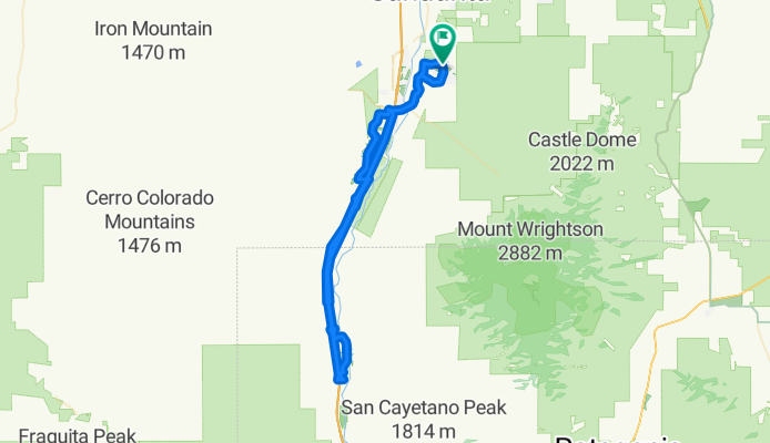
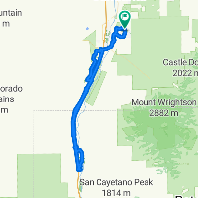
You have to get on the highway at Agua Linda for one exit, the frontage road does not go thru. Not as bad as it seems. Same thing happens on the return. Get on at Chavez Crossing.
Food at Tubac.
Altimeter says 1720 ft of climbing.
As flat as it gets.
- -:--
- Duration
- 84.6 km
- Distance
- 178 m
- Ascent
- 178 m
- Descent
- ---
- Avg. speed
- ---
- Avg. speed
Route quality
Waytypes & surfaces along the route
Waytypes
Road
60.7 km
(72 %)
Quiet road
17.8 km
(21 %)
Surfaces
Paved
5.5 km
(6 %)
Unpaved
4.4 km
(5 %)
Paved (undefined)
5.5 km
(6 %)
Unpaved (undefined)
4.4 km
(5 %)
Undefined
74.7 km
(88 %)
Continue with Bikemap
Use, edit, or download this cycling route
You would like to ride QuailCreek-Tubac-return or customize it for your own trip? Here is what you can do with this Bikemap route:
Free features
- Save this route as favorite or in collections
- Copy & plan your own version of this route
- Sync your route with Garmin or Wahoo
Premium features
Free trial for 3 days, or one-time payment. More about Bikemap Premium.
- Navigate this route on iOS & Android
- Export a GPX / KML file of this route
- Create your custom printout (try it for free)
- Download this route for offline navigation
Discover more Premium features.
Get Bikemap PremiumFrom our community
Other popular routes starting in East Sahuarita
 QuailCreek-Tubac-return
- Distance
- 84.6 km
- Ascent
- 178 m
- Descent
- 178 m
- Location
- East Sahuarita, Arizona, United States of America
 QuailCreek-HelmetPeak-Casino
- Distance
- 66 km
- Ascent
- 349 m
- Descent
- 349 m
- Location
- East Sahuarita, Arizona, United States of America
 San Xavier Mission from Quail Creek
- Distance
- 93.1 km
- Ascent
- 653 m
- Descent
- 653 m
- Location
- East Sahuarita, Arizona, United States of America
 QuailCreek-HelmetPeak-BackRoads
- Distance
- 51.2 km
- Ascent
- 323 m
- Descent
- 323 m
- Location
- East Sahuarita, Arizona, United States of America
 1418–1482 N Quail View Loop, Sahuarita to 1908 E Cliff Swallow Trail, Sahuarita
- Distance
- 9 km
- Ascent
- 32 m
- Descent
- 38 m
- Location
- East Sahuarita, Arizona, United States of America
Open it in the app