

De D248, Faverolles à 49 Faverolles, Faverolles
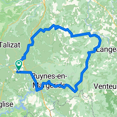
A cycling route starting in Saint-Flour, Auvergne-Rhône-Alpes, France.
Overview
About this route
- 1 h 45 min
- Duration
- 11.4 km
- Distance
- 189 m
- Ascent
- 196 m
- Descent
- 6.5 km/h
- Avg. speed
- ---
- Avg. speed
Continue with Bikemap
Use, edit, or download this cycling route
You would like to ride De D248, Faverolles à 49 Faverolles, Faverolles or customize it for your own trip? Here is what you can do with this Bikemap route:
Free features
- Save this route as favorite or in collections
- Copy & plan your own version of this route
- Sync your route with Garmin or Wahoo
Premium features
Free trial for 3 days, or one-time payment. More about Bikemap Premium.
- Navigate this route on iOS & Android
- Export a GPX / KML file of this route
- Create your custom printout (try it for free)
- Download this route for offline navigation
Discover more Premium features.
Get Bikemap PremiumFrom our community
Other popular routes starting in Saint-Flour
 Ruynes-en-Margeride / Domaine du Sauvage
- Distance
- 48.2 km
- Ascent
- 1,444 m
- Descent
- 1,019 m
- Location
- Saint-Flour, Auvergne-Rhône-Alpes, France
 courage les mecs
- Distance
- 57.4 km
- Ascent
- 531 m
- Descent
- 532 m
- Location
- Saint-Flour, Auvergne-Rhône-Alpes, France
 Les Gorges de la Truyère
- Distance
- 54.3 km
- Ascent
- 1,005 m
- Descent
- 1,005 m
- Location
- Saint-Flour, Auvergne-Rhône-Alpes, France
 Massiv Central 2009 - Tour 3 - Die Hochebene des Cezallier
- Distance
- 125.5 km
- Ascent
- 2,475 m
- Descent
- 2,488 m
- Location
- Saint-Flour, Auvergne-Rhône-Alpes, France
 Ruynes-en-Margeride - Saugues (Nr. 152)
- Distance
- 37.5 km
- Ascent
- 675 m
- Descent
- 611 m
- Location
- Saint-Flour, Auvergne-Rhône-Alpes, France
 Les Monts du Cantal
- Distance
- 158.8 km
- Ascent
- 2,150 m
- Descent
- 2,150 m
- Location
- Saint-Flour, Auvergne-Rhône-Alpes, France
 Massif Central 2009 - Tour 2 - Granitberge der Margeride
- Distance
- 115.7 km
- Ascent
- 2,301 m
- Descent
- 2,356 m
- Location
- Saint-Flour, Auvergne-Rhône-Alpes, France
 Massif Central 2009 - Tour 4 - Zum Plomb du Cantal
- Distance
- 114.1 km
- Ascent
- 2,977 m
- Descent
- 2,893 m
- Location
- Saint-Flour, Auvergne-Rhône-Alpes, France
Open it in the app