

Nancy - Gondrexange
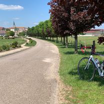
A cycling route starting in Villers-lès-Nancy, Alsace-Champagne-Ardenne-Lorraine, France.
Overview
About this route
Unterkunft: Camping Les Mouettes
- -:--
- Duration
- 70 km
- Distance
- 174 m
- Ascent
- 268 m
- Descent
- ---
- Avg. speed
- ---
- Avg. speed

Route quality
Waytypes & surfaces along the route
Waytypes
Path
28.4 km
(41 %)
Road
20.7 km
(29 %)
Surfaces
Paved
57.4 km
(82 %)
Unpaved
0.8 km
(1 %)
Asphalt
57.4 km
(82 %)
Gravel
0.6 km
(<1 %)
Continue with Bikemap
Use, edit, or download this cycling route
You would like to ride Nancy - Gondrexange or customize it for your own trip? Here is what you can do with this Bikemap route:
Free features
- Save this route as favorite or in collections
- Copy & plan your own version of this route
- Sync your route with Garmin or Wahoo
Premium features
Free trial for 3 days, or one-time payment. More about Bikemap Premium.
- Navigate this route on iOS & Android
- Export a GPX / KML file of this route
- Create your custom printout (try it for free)
- Download this route for offline navigation
Discover more Premium features.
Get Bikemap PremiumFrom our community
Other popular routes starting in Villers-lès-Nancy
 Nancy - Bèze (Côte d’Or)
- Distance
- 243.1 km
- Ascent
- 1,631 m
- Descent
- 1,648 m
- Location
- Villers-lès-Nancy, Alsace-Champagne-Ardenne-Lorraine, France
 Nancy - Vittel
- Distance
- 85.6 km
- Ascent
- 668 m
- Descent
- 566 m
- Location
- Villers-lès-Nancy, Alsace-Champagne-Ardenne-Lorraine, France
 Bitche
- Distance
- 132.4 km
- Ascent
- 632 m
- Descent
- 545 m
- Location
- Villers-lès-Nancy, Alsace-Champagne-Ardenne-Lorraine, France
 Donon – Rabodeau
- Distance
- 127.9 km
- Ascent
- 992 m
- Descent
- 928 m
- Location
- Villers-lès-Nancy, Alsace-Champagne-Ardenne-Lorraine, France
 Nancy – Blieskastel
- Distance
- 138.1 km
- Ascent
- 777 m
- Descent
- 792 m
- Location
- Villers-lès-Nancy, Alsace-Champagne-Ardenne-Lorraine, France
 Étang de Lindre
- Distance
- 130.5 km
- Ascent
- 237 m
- Descent
- 237 m
- Location
- Villers-lès-Nancy, Alsace-Champagne-Ardenne-Lorraine, France
 Côte de Toul - Gélaucourt
- Distance
- 101.9 km
- Ascent
- 1,050 m
- Descent
- 1,051 m
- Location
- Villers-lès-Nancy, Alsace-Champagne-Ardenne-Lorraine, France
 Nancy - St. Mihiel
- Distance
- 77 km
- Ascent
- 532 m
- Descent
- 546 m
- Location
- Villers-lès-Nancy, Alsace-Champagne-Ardenne-Lorraine, France
Open it in the app