

Im Erzgebirge: Von Gipfel zu Gipfel Teil 2
A cycling route starting in Rittersgrün, Saxony, Germany.
Overview
About this route
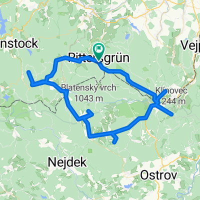
Nach Rittersgrün erreicht man auf tschechischem Gebiet die Halbmeiler Wiesen. Anschließend wechselt die Route zurück nach Deutschland zum Rabenberg. Auf Trails rollt es hinab bis Erlabrunn. Nach dem Auersberg wird das Hochmoor Kleiner Kranichsee passiert und der Gipfel des Plattenbergs erklommen. Hinter Abertamy folgt der Anstieg zum Pleßberg. Ab Jáchymov steigt der Weg zum Keilberg, an. Nun rauscht man dem höchsten Berg Sachsens entgegen und genießt das Panorama vom Fichtelberg. Von hier aus rollt es entlang der Himmelsleiter bis Oberwiesenthal hinab.
- -:--
- Duration
- 93.6 km
- Distance
- 2,807 m
- Ascent
- 2,540 m
- Descent
- ---
- Avg. speed
- ---
- Avg. speed

Continue with Bikemap
Use, edit, or download this cycling route
You would like to ride Im Erzgebirge: Von Gipfel zu Gipfel Teil 2 or customize it for your own trip? Here is what you can do with this Bikemap route:
Free features
- Save this route as favorite or in collections
- Copy & plan your own version of this route
- Sync your route with Garmin or Wahoo
Premium features
Free trial for 3 days, or one-time payment. More about Bikemap Premium.
- Navigate this route on iOS & Android
- Export a GPX / KML file of this route
- Create your custom printout (try it for free)
- Download this route for offline navigation
Discover more Premium features.
Get Bikemap PremiumFrom our community
Other popular routes starting in Rittersgrün
 R - Schlettau - Preßnitztal - Jöhstadt - Medenec - Bozi Dar - R
- Distance
- 108.6 km
- Ascent
- 1,081 m
- Descent
- 1,081 m
- Location
- Rittersgrün, Saxony, Germany
 002_Rittersgrün-Waschleithe-Geyer-Crottendorf-Raschau-Rittersgrün
- Distance
- 66.4 km
- Ascent
- 722 m
- Descent
- 722 m
- Location
- Rittersgrün, Saxony, Germany
 Käserei CZ
- Distance
- 25.7 km
- Ascent
- 409 m
- Descent
- 409 m
- Location
- Rittersgrün, Saxony, Germany
 Fünf 1000er Erzgebirge
- Distance
- 82.7 km
- Ascent
- 1,521 m
- Descent
- 1,521 m
- Location
- Rittersgrün, Saxony, Germany
 Erkundungstour
- Distance
- 13.2 km
- Ascent
- 338 m
- Descent
- 335 m
- Location
- Rittersgrün, Saxony, Germany
 SMQ MTB C-Edition Umleitung Drückjagd Rittersgrün-Fichtelberg 09.10.2021
- Distance
- 16 km
- Ascent
- 689 m
- Descent
- 135 m
- Location
- Rittersgrün, Saxony, Germany
 001_Rittersgrün - Steinbachtal - Bozi Dar - und zurück
- Distance
- 61 km
- Ascent
- 1,073 m
- Descent
- 1,074 m
- Location
- Rittersgrün, Saxony, Germany
 Roter Fuchs
- Distance
- 13.4 km
- Ascent
- 394 m
- Descent
- 397 m
- Location
- Rittersgrün, Saxony, Germany
Open it in the app