

Brisbane River Loop
A cycling route starting in Taringa, Queensland, Australia.
Overview
About this route
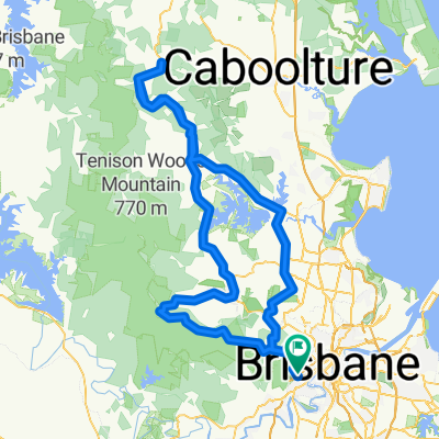
The Brisbane River Loop is popular recreational cycle route that follows the Brisbane River from South Bank to Indooroopilly and back again.
This route is popular on weekends with cyclists of all stripes heading out to get some fresh air and exercise. The majority of the route is on residential back streets, although there are some more busy stretches further out of the city. There is a good mix of flat and hill cycling, and you can also choose the Mini Brisbane River Loop should the full loop prove too challenging.
The full loop is 35-40 km, whereas the mini loop is slightly under 20 km.
- -:--
- Duration
- 38 km
- Distance
- 162 m
- Ascent
- 165 m
- Descent
- ---
- Avg. speed
- ---
- Avg. speed

Route quality
Waytypes & surfaces along the route
Waytypes
Cycleway
14.8 km
(39 %)
Quiet road
11.3 km
(30 %)
Surfaces
Paved
37.7 km
(99 %)
Asphalt
27.4 km
(72 %)
Concrete
9.5 km
(25 %)
Continue with Bikemap
Use, edit, or download this cycling route
You would like to ride Brisbane River Loop or customize it for your own trip? Here is what you can do with this Bikemap route:
Free features
- Save this route as favorite or in collections
- Copy & plan your own version of this route
- Sync your route with Garmin or Wahoo
Premium features
Free trial for 3 days, or one-time payment. More about Bikemap Premium.
- Navigate this route on iOS & Android
- Export a GPX / KML file of this route
- Create your custom printout (try it for free)
- Download this route for offline navigation
Discover more Premium features.
Get Bikemap PremiumFrom our community
Other popular routes starting in Taringa
 River Loop: Jindalee-Teneriffe
- Distance
- 35.4 km
- Ascent
- 179 m
- Descent
- 179 m
- Location
- Taringa, Queensland, Australia
 bike tour from Mount Coot-Tha to Fig Tree Pocket
- Distance
- 18.7 km
- Ascent
- 390 m
- Descent
- 440 m
- Location
- Taringa, Queensland, Australia
 The Toowong Gateway Loop
- Distance
- 65.2 km
- Ascent
- 5,200 m
- Descent
- 5,200 m
- Location
- Taringa, Queensland, Australia
 Mt Cootha + riverloop
- Distance
- 53.5 km
- Ascent
- 608 m
- Descent
- 626 m
- Location
- Taringa, Queensland, Australia
 28 Ada Street, Toowong to 30 Ada Street, Toowong
- Distance
- 10.9 km
- Ascent
- 0 m
- Descent
- 10 m
- Location
- Taringa, Queensland, Australia
 River Loop Chelmer-Valley
- Distance
- 41.9 km
- Ascent
- 188 m
- Descent
- 188 m
- Location
- Taringa, Queensland, Australia
 3 figures route
- Distance
- 67.9 km
- Ascent
- 449 m
- Descent
- 453 m
- Location
- Taringa, Queensland, Australia
 Toowong, Mt Mee, Samford, Mt Nebo loop
- Distance
- 165.9 km
- Ascent
- 1,274 m
- Descent
- 1,271 m
- Location
- Taringa, Queensland, Australia
Open it in the app