

Route 17: Gata Gorgos-Javea-Cabo Nao-Teulada
A cycling route starting in Xàbia, Valencia, Spain.
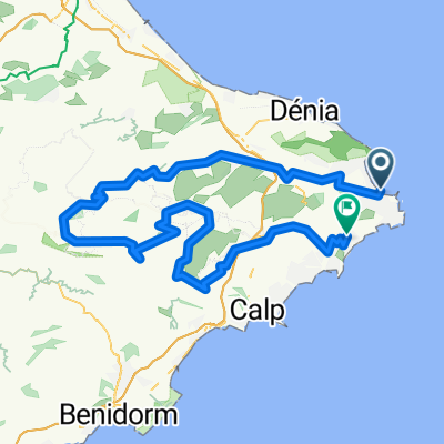
Overview
About this route
JAVEA .rotunda
Toscamar .......................06
>> Alto (129m).................12
Cabo de la Nao [52m] ....14
La Finca - a gauche.........22
Benitachell (144m)..........28
Teulada (152m)...............32
Alto (188m)......................33
Urbanisaciones...............36
Javea..............................41
- -:--
- Duration
- 41 km
- Distance
- 612 m
- Ascent
- 612 m
- Descent
- ---
- Avg. speed
- 188 m
- Avg. speed

Route quality
Waytypes & surfaces along the route
Waytypes
Busy road
31 km
(76 %)
Quiet road
9.4 km
(23 %)
Surfaces
Paved
15.9 km
(39 %)
Asphalt
15.8 km
(39 %)
Paved (undefined)
0.1 km
(<1 %)
Undefined
25.1 km
(61 %)
Continue with Bikemap
Use, edit, or download this cycling route
You would like to ride Route 17: Gata Gorgos-Javea-Cabo Nao-Teulada or customize it for your own trip? Here is what you can do with this Bikemap route:
Free features
- Save this route as favorite or in collections
- Copy & plan your own version of this route
- Sync your route with Garmin or Wahoo
Premium features
Free trial for 3 days, or one-time payment. More about Bikemap Premium.
- Navigate this route on iOS & Android
- Export a GPX / KML file of this route
- Create your custom printout (try it for free)
- Download this route for offline navigation
Discover more Premium features.
Get Bikemap PremiumFrom our community
Other popular routes starting in Xàbia
 Xabia bearbeitet 37km
- Distance
- 36.9 km
- Ascent
- 545 m
- Descent
- 540 m
- Location
- Xàbia, Valencia, Spain
 XABIA-BENISIVA
- Distance
- 117.7 km
- Ascent
- 1,243 m
- Descent
- 1,248 m
- Location
- Xàbia, Valencia, Spain
 javea
javea- Distance
- 129.5 km
- Ascent
- 2,003 m
- Descent
- 1,614 m
- Location
- Xàbia, Valencia, Spain
 Les Planes del Montgó
- Distance
- 12 km
- Ascent
- 237 m
- Descent
- 238 m
- Location
- Xàbia, Valencia, Spain
 javea
javea- Distance
- 11.6 km
- Ascent
- 509 m
- Descent
- 111 m
- Location
- Xàbia, Valencia, Spain
 Xabia Valencia por la costa - back roads
- Distance
- 112.9 km
- Ascent
- 108 m
- Descent
- 177 m
- Location
- Xàbia, Valencia, Spain
 Javea 111km to Castell de Castells
- Distance
- 111 km
- Ascent
- 1,331 m
- Descent
- 1,326 m
- Location
- Xàbia, Valencia, Spain
 javea-benitachell
- Distance
- 12.9 km
- Ascent
- 454 m
- Descent
- 122 m
- Location
- Xàbia, Valencia, Spain
Open it in the app