

Esteolal Road, Kabol to Unnamed Road, Kabol
A cycling route starting in Kabul, Kabul, Afghanistan.
Overview
About this route
- 3 h 49 min
- Duration
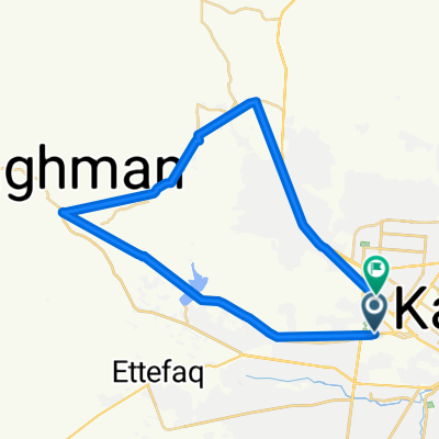
- 16.5 km
- Distance
- 53 m
- Ascent
- 60 m
- Descent
- 4.3 km/h
- Avg. speed
- ---
- Avg. speed

Continue with Bikemap
Use, edit, or download this cycling route
You would like to ride Esteolal Road, Kabol to Unnamed Road, Kabol or customize it for your own trip? Here is what you can do with this Bikemap route:
Free features
- Save this route as favorite or in collections
- Copy & plan your own version of this route
- Sync your route with Garmin or Wahoo
Premium features
Free trial for 3 days, or one-time payment. More about Bikemap Premium.
- Navigate this route on iOS & Android
- Export a GPX / KML file of this route
- Create your custom printout (try it for free)
- Download this route for offline navigation
Discover more Premium features.
Get Bikemap PremiumFrom our community
Other popular routes starting in Kabul
 Esteolal Road, Kabol to Unnamed Road, Kabol
- Distance
- 16.5 km
- Ascent
- 53 m
- Descent
- 60 m
- Location
- Kabul, Kabul, Afghanistan
 Flag Tapa
- Distance
- 21 km
- Ascent
- 7,021 m
- Descent
- 7,033 m
- Location
- Kabul, Kabul, Afghanistan
 Steady ride in کابل
- Distance
- 47.6 km
- Ascent
- 670 m
- Descent
- 674 m
- Location
- Kabul, Kabul, Afghanistan
 Steady ride in Hazara-I-Baghal
- Distance
- 36.4 km
- Ascent
- 301 m
- Descent
- 294 m
- Location
- Kabul, Kabul, Afghanistan
 Slow ride in
- Distance
- 14.9 km
- Ascent
- 336 m
- Descent
- 29 m
- Location
- Kabul, Kabul, Afghanistan
 Service Road, Kabol to سرگ سالنگ, Kabol
- Distance
- 42.5 km
- Ascent
- 569 m
- Descent
- 584 m
- Location
- Kabul, Kabul, Afghanistan
 Kábul - Dháka
- Distance
- 3,111.2 km
- Ascent
- 1,015 m
- Descent
- 2,804 m
- Location
- Kabul, Kabul, Afghanistan
 کابل to Kabul - Nangarhar Highway, Kabol
- Distance
- 16.9 km
- Ascent
- 172 m
- Descent
- 228 m
- Location
- Kabul, Kabul, Afghanistan
Open it in the app