

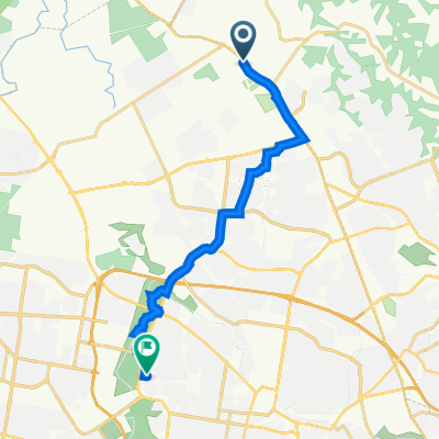
Tallawong to Windsor, via Vineyard and Mulgrave stations - 17.6km
A cycling route starting in Rouse Hill, New South Wales, Australia.
Overview
About this route
Tallawong station to Windsor, R into Schofields Rd, R intoTallawong Rd, L into Guntawong Rd, R into Clarke St, Ahead into Edmund St, L into Crown St, R into Riverstone Pde thru Vineyard and Mulgrave stations - 17.6km
- -:--
- Duration
- 17.6 km
- Distance
- 99 m
- Ascent
- 142 m
- Descent
- ---
- Avg. speed
- ---
- Avg. speed

Route quality
Waytypes & surfaces along the route
Waytypes
Quiet road
6.1 km
(34 %)
Road
5.6 km
(32 %)
Surfaces
Paved
15.1 km
(85 %)
Asphalt
9.2 km
(52 %)
Paved (undefined)
5.1 km
(29 %)
Continue with Bikemap
Use, edit, or download this cycling route
You would like to ride Tallawong to Windsor, via Vineyard and Mulgrave stations - 17.6km or customize it for your own trip? Here is what you can do with this Bikemap route:
Free features
- Save this route as favorite or in collections
- Copy & plan your own version of this route
- Sync your route with Garmin or Wahoo
Premium features
Free trial for 3 days, or one-time payment. More about Bikemap Premium.
- Navigate this route on iOS & Android
- Export a GPX / KML file of this route
- Create your custom printout (try it for free)
- Download this route for offline navigation
Discover more Premium features.
Get Bikemap PremiumFrom our community
Other popular routes starting in Rouse Hill
 1106 Windsor Rd, Riverstone to 65 Graham St, Doonside
- Distance
- 16 km
- Ascent
- 121 m
- Descent
- 114 m
- Location
- Rouse Hill, New South Wales, Australia
 5 Regis Grove, Rouse Hill to 30 Harvard Cct, Rouse Hill
- Distance
- 7.9 km
- Ascent
- 106 m
- Descent
- 115 m
- Location
- Rouse Hill, New South Wales, Australia
 Rouse Hill Longer
- Distance
- 14.5 km
- Ascent
- 165 m
- Descent
- 168 m
- Location
- Rouse Hill, New South Wales, Australia
 All the way down M7
- Distance
- 62.7 km
- Ascent
- 646 m
- Descent
- 646 m
- Location
- Rouse Hill, New South Wales, Australia
 110 Main St, Rouse Hill to 52 Whitewood Cr, Kellyville Ridge
- Distance
- 3.6 km
- Ascent
- 41 m
- Descent
- 30 m
- Location
- Rouse Hill, New South Wales, Australia
 5 Regis Grove, Rouse Hill to 5 Regis Grove, Rouse Hill
- Distance
- 8.4 km
- Ascent
- 91 m
- Descent
- 91 m
- Location
- Rouse Hill, New South Wales, Australia
 Rosario Place, Rouse Hill to Rosario Place, Rouse Hill
- Distance
- 42.3 km
- Ascent
- 417 m
- Descent
- 424 m
- Location
- Rouse Hill, New South Wales, Australia
 Relaxed route in The Ponds
- Distance
- 7 km
- Ascent
- 65 m
- Descent
- 71 m
- Location
- Rouse Hill, New South Wales, Australia
Open it in the app