

Wasserwege Bottrop
A cycling route starting in Bottrop, North Rhine-Westphalia, Germany.
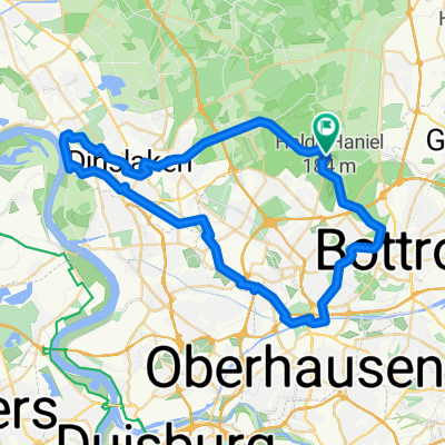
Overview
About this route
Wasserwege von Bottrop zum Rhein, Wesel-Datteln-Kanal
- -:--
- Duration
- 80.9 km
- Distance
- 180 m
- Ascent
- 181 m
- Descent
- ---
- Avg. speed
- ---
- Avg. speed

Route quality
Waytypes & surfaces along the route
Waytypes
Path
24.4 km
(30 %)
Quiet road
22.2 km
(27 %)
Surfaces
Paved
26.7 km
(33 %)
Unpaved
29.1 km
(36 %)
Asphalt
23.3 km
(29 %)
Gravel
22.7 km
(28 %)
Route highlights
Points of interest along the route
Point of interest after 3.2 km
Burg Vondern
Point of interest after 19.7 km
Walsumer Quellen
Point of interest after 25.2 km
Imbiss
Point of interest after 25.2 km
Neue Emschermündung
Point of interest after 44 km
Wesel-Datteln-Kanal
Point of interest after 58.5 km
Halde Lohberg
Point of interest after 78 km
Revierpark Vonderort
Continue with Bikemap
Use, edit, or download this cycling route
You would like to ride Wasserwege Bottrop or customize it for your own trip? Here is what you can do with this Bikemap route:
Free features
- Save this route as favorite or in collections
- Copy & plan your own version of this route
- Sync your route with Garmin or Wahoo
Premium features
Free trial for 3 days, or one-time payment. More about Bikemap Premium.
- Navigate this route on iOS & Android
- Export a GPX / KML file of this route
- Create your custom printout (try it for free)
- Download this route for offline navigation
Discover more Premium features.
Get Bikemap PremiumFrom our community
Other popular routes starting in Bottrop
 38 Oberhausen Halde Hohenwarth Westerholt
- Distance
- 70.8 km
- Ascent
- 276 m
- Descent
- 282 m
- Location
- Bottrop, North Rhine-Westphalia, Germany
 RVR - Kirchheller Heide
- Distance
- 26.4 km
- Ascent
- 77 m
- Descent
- 87 m
- Location
- Bottrop, North Rhine-Westphalia, Germany
 Zollverein, Mülheim Wasserbahnhof, Centro
- Distance
- 49.4 km
- Ascent
- 382 m
- Descent
- 382 m
- Location
- Bottrop, North Rhine-Westphalia, Germany
 Bottrop-Oberhausen-Duisburg-Bottrop
- Distance
- 55.7 km
- Ascent
- 112 m
- Descent
- 112 m
- Location
- Bottrop, North Rhine-Westphalia, Germany
 10 Grafenmühle - Bottr. Stadtpark
- Distance
- 14.5 km
- Ascent
- 84 m
- Descent
- 83 m
- Location
- Bottrop, North Rhine-Westphalia, Germany
 Radrunde durch Bottrop
- Distance
- 13.4 km
- Ascent
- 72 m
- Descent
- 70 m
- Location
- Bottrop, North Rhine-Westphalia, Germany
 Osterfeld - Wesel (Grav-Insel) und zurück
- Distance
- 87.9 km
- Ascent
- 129 m
- Descent
- 141 m
- Location
- Bottrop, North Rhine-Westphalia, Germany
 große Rotbach Rundtour
- Distance
- 50.3 km
- Ascent
- 140 m
- Descent
- 140 m
- Location
- Bottrop, North Rhine-Westphalia, Germany
Open it in the app