

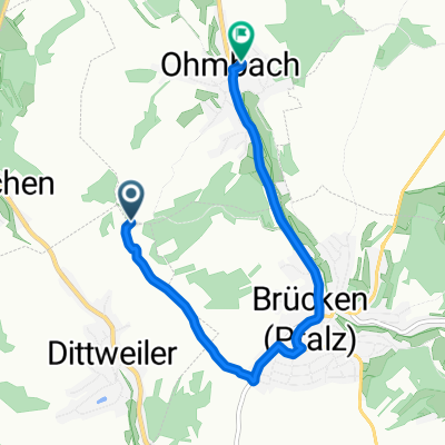
Vom Kohlbachtal zum Industriegebiet Ost in Homburg
A cycling route starting in Dittweiler, Rhineland-Palatinate, Germany.
Overview
About this route
Man kann mit einem Mountainbike vom Kohlbachtal zum Industriegebiet Ost in Homburg fahren
- -:--
- Duration
- 13.4 km
- Distance
- 88 m
- Ascent
- 112 m
- Descent
- ---
- Avg. speed
- 284 m
- Avg. speed
Route quality
Waytypes & surfaces along the route
Waytypes
Track
4.8 km
(36 %)
Busy road
2.8 km
(21 %)
Surfaces
Paved
8.3 km
(62 %)
Unpaved
4.3 km
(33 %)
Asphalt
7.4 km
(56 %)
Gravel
2 km
(15 %)
Continue with Bikemap
Use, edit, or download this cycling route
You would like to ride Vom Kohlbachtal zum Industriegebiet Ost in Homburg or customize it for your own trip? Here is what you can do with this Bikemap route:
Free features
- Save this route as favorite or in collections
- Copy & plan your own version of this route
- Sync your route with Garmin or Wahoo
Premium features
Free trial for 3 days, or one-time payment. More about Bikemap Premium.
- Navigate this route on iOS & Android
- Export a GPX / KML file of this route
- Create your custom printout (try it for free)
- Download this route for offline navigation
Discover more Premium features.
Get Bikemap PremiumFrom our community
Other popular routes starting in Dittweiler
 Vom Kohlbachtal zum Industriegebiet Ost in Homburg
- Distance
- 13.4 km
- Ascent
- 88 m
- Descent
- 112 m
- Location
- Dittweiler, Rhineland-Palatinate, Germany
 Dittweiler-Bostalsee
- Distance
- 43.1 km
- Ascent
- 558 m
- Descent
- 418 m
- Location
- Dittweiler, Rhineland-Palatinate, Germany
 Römerstraße 18, Dittweiler nach Eichelscheiderstraße 27, Waldmohr
- Distance
- 10.3 km
- Ascent
- 546 m
- Descent
- 553 m
- Location
- Dittweiler, Rhineland-Palatinate, Germany
 Am Klingbach 38, Schönenberg-Kübelberg nach Mulden 71, Münstertal/Schwarzwald
- Distance
- 255 km
- Ascent
- 1,916 m
- Descent
- 1,619 m
- Location
- Dittweiler, Rhineland-Palatinate, Germany
 Sankt Wendeler Straße, Brücken (Pfalz) nach Luisenstraße 14, St. Wendel
- Distance
- 17.8 km
- Ascent
- 379 m
- Descent
- 358 m
- Location
- Dittweiler, Rhineland-Palatinate, Germany
 Route to Höferstraße 10, Ohmbach
- Distance
- 5.1 km
- Ascent
- 19 m
- Descent
- 124 m
- Location
- Dittweiler, Rhineland-Palatinate, Germany
 Am Klingbach 40, Schönenberg-Kübelberg nach Luitpoldstraße 12, Homburg
- Distance
- 9.2 km
- Ascent
- 114 m
- Descent
- 136 m
- Location
- Dittweiler, Rhineland-Palatinate, Germany
Open it in the app