

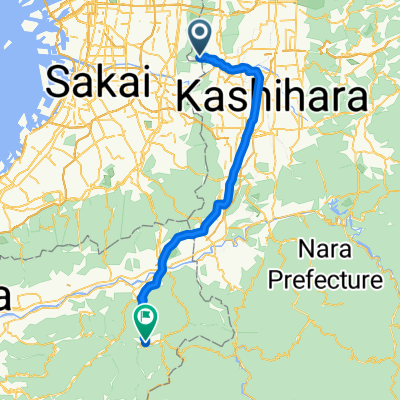
15-2, Kudo 2-Chōme, Oji, Kitakatsuragi-Gun to 2, Kudo 2-Chōme, Oji, Kitakatsuragi-Gun
A cycling route starting in Kashihara, Ōsaka, Japan.
Overview
About this route
- 1 h 38 min
- Duration
- 27.1 km
- Distance
- 493 m
- Ascent
- 491 m
- Descent
- 16.5 km/h
- Avg. speed
- ---
- Avg. speed
Continue with Bikemap
Use, edit, or download this cycling route
You would like to ride 15-2, Kudo 2-Chōme, Oji, Kitakatsuragi-Gun to 2, Kudo 2-Chōme, Oji, Kitakatsuragi-Gun or customize it for your own trip? Here is what you can do with this Bikemap route:
Free features
- Save this route as favorite or in collections
- Copy & plan your own version of this route
- Sync your route with Garmin or Wahoo
Premium features
Free trial for 3 days, or one-time payment. More about Bikemap Premium.
- Navigate this route on iOS & Android
- Export a GPX / KML file of this route
- Create your custom printout (try it for free)
- Download this route for offline navigation
Discover more Premium features.
Get Bikemap PremiumFrom our community
Other popular routes starting in Kashihara
 柏原市民文化会館 リビエールホール
- Distance
- 3.4 km
- Ascent
- 3 m
- Descent
- 0 m
- Location
- Kashihara, Ōsaka, Japan
 大阪→岐阜
大阪→岐阜- Distance
- 185.2 km
- Ascent
- 1,160 m
- Descent
- 1,166 m
- Location
- Kashihara, Ōsaka, Japan
 3丁目, 八尾市 まで堺市
- Distance
- 15.2 km
- Ascent
- 37 m
- Descent
- 25 m
- Location
- Kashihara, Ōsaka, Japan
 デザインホテル
- Distance
- 10 km
- Ascent
- 17 m
- Descent
- 25 m
- Location
- Kashihara, Ōsaka, Japan
 ル・カフェ・サリュ加美
- Distance
- 6 km
- Ascent
- 4 m
- Descent
- 6 m
- Location
- Kashihara, Ōsaka, Japan
 1,柏原〜彼方
- Distance
- 14.5 km
- Ascent
- 80 m
- Descent
- 23 m
- Location
- Kashihara, Ōsaka, Japan
 河内長野→狭山→堺
- Distance
- 56.5 km
- Ascent
- 449 m
- Descent
- 448 m
- Location
- Kashihara, Ōsaka, Japan
 Shigisan to Koyasan
- Distance
- 62.6 km
- Ascent
- 1,238 m
- Descent
- 696 m
- Location
- Kashihara, Ōsaka, Japan
Open it in the app