

Hechlingen Wander-Rundweg 17
A cycling route starting in Heidenheim, Bavaria, Germany.
Overview
About this route
Rundwanderweg mit den Hightlights Steinerne Rinne, Katherinenkapelle, Lehrpfad und Hohlweg.
- -:--
- Duration
- 5.2 km
- Distance
- 146 m
- Ascent
- 146 m
- Descent
- ---
- Avg. speed
- ---
- Avg. speed

Route quality
Waytypes & surfaces along the route
Waytypes
Track
4.9 km
(94 %)
Access road
0.2 km
(3 %)
Surfaces
Paved
0.9 km
(17 %)
Unpaved
3.5 km
(66 %)
Ground
2.2 km
(42 %)
Unpaved (undefined)
0.9 km
(17 %)
Continue with Bikemap
Use, edit, or download this cycling route
You would like to ride Hechlingen Wander-Rundweg 17 or customize it for your own trip? Here is what you can do with this Bikemap route:
Free features
- Save this route as favorite or in collections
- Copy & plan your own version of this route
- Sync your route with Garmin or Wahoo
Premium features
Free trial for 3 days, or one-time payment. More about Bikemap Premium.
- Navigate this route on iOS & Android
- Export a GPX / KML file of this route
- Create your custom printout (try it for free)
- Download this route for offline navigation
Discover more Premium features.
Get Bikemap PremiumFrom our community
Other popular routes starting in Heidenheim
 Spielberg, Oettingen u zurück
- Distance
- 41.1 km
- Ascent
- 363 m
- Descent
- 334 m
- Location
- Heidenheim, Bavaria, Germany
 Heidenheim Eichstätt Ingolstadt
- Distance
- 83.3 km
- Ascent
- 920 m
- Descent
- 1,071 m
- Location
- Heidenheim, Bavaria, Germany
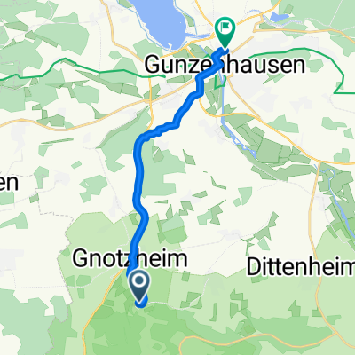 von Spielberg nach Gunzenhausen
- Distance
- 11.1 km
- Ascent
- 30 m
- Descent
- 191 m
- Location
- Heidenheim, Bavaria, Germany
 Spielberg - Dennenlohe
- Distance
- 27.7 km
- Ascent
- 241 m
- Descent
- 241 m
- Location
- Heidenheim, Bavaria, Germany
 Spielbergrunde
- Distance
- 21.8 km
- Ascent
- 428 m
- Descent
- 423 m
- Location
- Heidenheim, Bavaria, Germany
 Hahnenkamm
- Distance
- 18.2 km
- Ascent
- 442 m
- Descent
- 443 m
- Location
- Heidenheim, Bavaria, Germany
 Heidenheim Ingolstadt HBF
- Distance
- 89.7 km
- Ascent
- 1,070 m
- Descent
- 1,225 m
- Location
- Heidenheim, Bavaria, Germany
 Rund um den Altmühlsee
- Distance
- 54.9 km
- Ascent
- 165 m
- Descent
- 158 m
- Location
- Heidenheim, Bavaria, Germany
Open it in the app