

Gleidingen-Hildesheimer_Wald-Marienburg
A cycling route starting in Sarstedt, Lower Saxony, Germany.
Overview
About this route
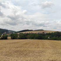
Von Gleidingen durch die Feldmark meist auf Feldwegen über Giften, Giesen, Hildesheim bis zum Sorsumer Berg. Weiter über den Kammweg des Hildesheimer Waldes. Anschließend durch Nordstemmen zur Marienburg und über das Calenberger Land zurück nach Gleidingen. Lt. Garmin GPS 620 Höhenmeter.
- -:--
- Duration
- 57.4 km
- Distance
- 391 m
- Ascent
- 391 m
- Descent
- ---
- Avg. speed
- ---
- Avg. speed
Route quality
Waytypes & surfaces along the route
Waytypes
Track
28.3 km
(49 %)
Quiet road
11 km
(19 %)
Surfaces
Paved
37.4 km
(65 %)
Unpaved
16.1 km
(28 %)
Asphalt
28.5 km
(50 %)
Gravel
11.2 km
(19 %)
Continue with Bikemap
Use, edit, or download this cycling route
You would like to ride Gleidingen-Hildesheimer_Wald-Marienburg or customize it for your own trip? Here is what you can do with this Bikemap route:
Free features
- Save this route as favorite or in collections
- Copy & plan your own version of this route
- Sync your route with Garmin or Wahoo
Premium features
Free trial for 3 days, or one-time payment. More about Bikemap Premium.
- Navigate this route on iOS & Android
- Export a GPX / KML file of this route
- Create your custom printout (try it for free)
- Download this route for offline navigation
Discover more Premium features.
Get Bikemap PremiumFrom our community
Other popular routes starting in Sarstedt
 Leinemasch Störche
- Distance
- 29.8 km
- Ascent
- 20 m
- Descent
- 22 m
- Location
- Sarstedt, Lower Saxony, Germany
 Sarstedt —BAD SALZDETFURTH - Tour
- Distance
- 62.7 km
- Ascent
- 475 m
- Descent
- 524 m
- Location
- Sarstedt, Lower Saxony, Germany
 Ausflug 2
- Distance
- 46.7 km
- Ascent
- 393 m
- Descent
- 224 m
- Location
- Sarstedt, Lower Saxony, Germany
 Moorberg 1, Sarstedt nach Ostertorstraße 6, Sarstedt
- Distance
- 13.3 km
- Ascent
- 4 m
- Descent
- 0 m
- Location
- Sarstedt, Lower Saxony, Germany
 Landkreis Hildesheim Joschka 2020
- Distance
- 183.7 km
- Ascent
- 681 m
- Descent
- 681 m
- Location
- Sarstedt, Lower Saxony, Germany
 Rund um den Kaliberg
- Distance
- 18.9 km
- Ascent
- 48 m
- Descent
- 49 m
- Location
- Sarstedt, Lower Saxony, Germany
 Sarstedt bis Neustadt auf Leineradweg
- Distance
- 56.4 km
- Ascent
- 87 m
- Descent
- 110 m
- Location
- Sarstedt, Lower Saxony, Germany
 Ab_zur_Marienburg
- Distance
- 13.8 km
- Ascent
- 147 m
- Descent
- 109 m
- Location
- Sarstedt, Lower Saxony, Germany
Open it in the app