

ALGAR DEL PALANCIA- Soneja
A cycling route starting in Xirivella, Valencia, Spain.
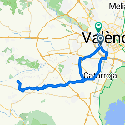
Overview
About this route
- -:--
- Duration
- 110.6 km
- Distance
- 863 m
- Ascent
- 873 m
- Descent
- ---
- Avg. speed
- ---
- Avg. speed

Route quality
Waytypes & surfaces along the route
Waytypes
Quiet road
36.5 km
(33 %)
Road
33.1 km
(30 %)
Surfaces
Paved
15.9 km
(14 %)
Unpaved
11.3 km
(10 %)
Paved (undefined)
8.5 km
(8 %)
Gravel
8.3 km
(8 %)
Continue with Bikemap
Use, edit, or download this cycling route
You would like to ride ALGAR DEL PALANCIA- Soneja or customize it for your own trip? Here is what you can do with this Bikemap route:
Free features
- Save this route as favorite or in collections
- Copy & plan your own version of this route
- Sync your route with Garmin or Wahoo
Premium features
Free trial for 3 days, or one-time payment. More about Bikemap Premium.
- Navigate this route on iOS & Android
- Export a GPX / KML file of this route
- Create your custom printout (try it for free)
- Download this route for offline navigation
Discover more Premium features.
Get Bikemap PremiumFrom our community
Other popular routes starting in Xirivella
 BUÑOL Por Vilarmarxant, Xiva y cuatro caminos
- Distance
- 94.9 km
- Ascent
- 525 m
- Descent
- 522 m
- Location
- Xirivella, Valencia, Spain
 PTO de ESLIDA
- Distance
- 157.4 km
- Ascent
- 1,122 m
- Descent
- 1,126 m
- Location
- Xirivella, Valencia, Spain
 Xirivella - Montserrat por el Clot
- Distance
- 62.8 km
- Ascent
- 315 m
- Descent
- 312 m
- Location
- Xirivella, Valencia, Spain
 Valencia-Picaña-Calicanto-Valencia
- Distance
- 40.6 km
- Ascent
- 309 m
- Descent
- 308 m
- Location
- Xirivella, Valencia, Spain
 Barco cortixelles
- Distance
- 51.8 km
- Ascent
- 298 m
- Descent
- 298 m
- Location
- Xirivella, Valencia, Spain
 Valencia Urb-Monte Tesoro en Turis por interior
- Distance
- 64.1 km
- Ascent
- 312 m
- Descent
- 312 m
- Location
- Xirivella, Valencia, Spain
 La MARJANA
- Distance
- 135.2 km
- Ascent
- 1,016 m
- Descent
- 1,016 m
- Location
- Xirivella, Valencia, Spain
 CHIVA por Loriguilla
- Distance
- 86.8 km
- Ascent
- 452 m
- Descent
- 452 m
- Location
- Xirivella, Valencia, Spain
Open it in the app