
Lohrgraben 17, Waldlaubersheim do Kapellenstraße 3, Feilbingert
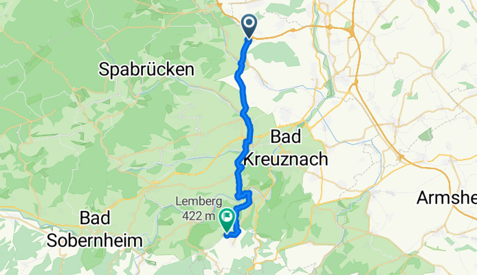
A cycling route starting in Waldlaubersheim, Rhineland-Palatinate, Germany.
Overview
About this route
- 1 h 2 min
- Duration
- 21.8 km
- Distance
- 333 m
- Ascent
- 304 m
- Descent
- 21.1 km/h
- Avg. speed
- ---
- Avg. speed

Route quality
Waytypes & surfaces along the route
Waytypes
Track
8.3 km
(38 %)
Busy road
4.6 km
(21 %)
Surfaces
Paved
19.2 km
(88 %)
Unpaved
1.2 km
(5 %)
Asphalt
17.3 km
(79 %)
Paved (undefined)
1.6 km
(7 %)
Continue with Bikemap
Use, edit, or download this cycling route
You would like to ride Lohrgraben 17, Waldlaubersheim do Kapellenstraße 3, Feilbingert or customize it for your own trip? Here is what you can do with this Bikemap route:
Free features
- Save this route as favorite or in collections
- Copy & plan your own version of this route
- Sync your route with Garmin or Wahoo
Premium features
Free trial for 3 days, or one-time payment. More about Bikemap Premium.
- Navigate this route on iOS & Android
- Export a GPX / KML file of this route
- Create your custom printout (try it for free)
- Download this route for offline navigation
Discover more Premium features.
Get Bikemap PremiumFrom our community
Other popular routes starting in Waldlaubersheim
 037c MFP Waldlaubersheim - Rheinböllen - Simmern - Holzbach - Tiefenbach - MFP Waldlaubersheim
- Distance
- 66.4 km
- Ascent
- 884 m
- Descent
- 884 m
- Location
- Waldlaubersheim, Rhineland-Palatinate, Germany
 025b Waldlaubersheim - Forsthaus Neupfalz - Manubach - Bacharach - Steeg - Stromberg - Waldlaubersheim
- Distance
- 64.9 km
- Ascent
- 1,126 m
- Descent
- 1,024 m
- Location
- Waldlaubersheim, Rhineland-Palatinate, Germany
 025c Waldlaubersheim - Stromberg - Dichtelbach - Bacharach - Steeg - Rheinböllen - Waldlaubersheim
- Distance
- 60.4 km
- Ascent
- 958 m
- Descent
- 833 m
- Location
- Waldlaubersheim, Rhineland-Palatinate, Germany
 052a MFP Waldlaubersheim - Weitersborn - Griebelschied - Rhaunen - Kreershäuschen - MFP Waldlaubersheim
- Distance
- 106.8 km
- Ascent
- 1,334 m
- Descent
- 1,336 m
- Location
- Waldlaubersheim, Rhineland-Palatinate, Germany
 037a/b MFP Waldlaubersheim - Rheinböllen - Simmern - Ravengiersburg - Tiefenbach - MFP Waldlaubersheim
- Distance
- 80.2 km
- Ascent
- 958 m
- Descent
- 958 m
- Location
- Waldlaubersheim, Rhineland-Palatinate, Germany
 3. Auslandstour 2018 Gruppe 3
- Distance
- 60.9 km
- Ascent
- 840 m
- Descent
- 840 m
- Location
- Waldlaubersheim, Rhineland-Palatinate, Germany
 Auslandstour 2017 - Waldlaubersheim
- Distance
- 78.5 km
- Ascent
- 918 m
- Descent
- 918 m
- Location
- Waldlaubersheim, Rhineland-Palatinate, Germany
 038a_Waldlaubersheim - Langenthal - Gemünden - Ravengiersburg - Tiefenbach - Stromberg - Waldlaubersheim
- Distance
- 101.2 km
- Ascent
- 1,952 m
- Descent
- 1,822 m
- Location
- Waldlaubersheim, Rhineland-Palatinate, Germany
Open it in the app