

Palmbach – Thomashof – Mutschelbach – Palmbach-
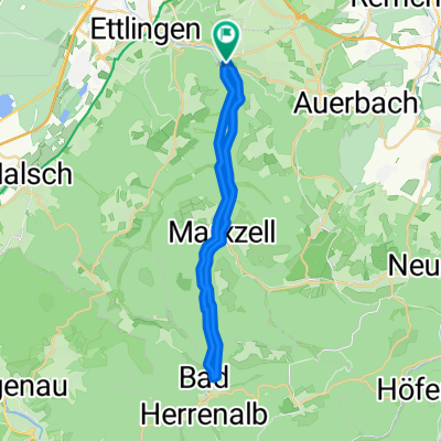
A cycling route starting in Ettlingen, Baden-Württemberg, Germany.
Overview
About this route
Asphaltierte und geschotterte Wege, ausschließlich Wald- und Forstwege, Radwege oder Nebenstraßen. Kindertauglich
- -:--
- Duration
- 13.4 km
- Distance
- 182 m
- Ascent
- 174 m
- Descent
- ---
- Avg. speed
- ---
- Avg. speed
Route quality
Waytypes & surfaces along the route
Waytypes
Track
9.3 km
(70 %)
Access road
2.3 km
(17 %)
Surfaces
Paved
10.1 km
(75 %)
Unpaved
2.4 km
(18 %)
Asphalt
8 km
(60 %)
Gravel
2.4 km
(18 %)
Continue with Bikemap
Use, edit, or download this cycling route
You would like to ride Palmbach – Thomashof – Mutschelbach – Palmbach- or customize it for your own trip? Here is what you can do with this Bikemap route:
Free features
- Save this route as favorite or in collections
- Copy & plan your own version of this route
- Sync your route with Garmin or Wahoo
Premium features
Free trial for 3 days, or one-time payment. More about Bikemap Premium.
- Navigate this route on iOS & Android
- Export a GPX / KML file of this route
- Create your custom printout (try it for free)
- Download this route for offline navigation
Discover more Premium features.
Get Bikemap PremiumFrom our community
Other popular routes starting in Ettlingen
 ka - spessart - burbach - dobel - turmberg
- Distance
- 77.7 km
- Ascent
- 900 m
- Descent
- 900 m
- Location
- Ettlingen, Baden-Württemberg, Germany
 Albtal
- Distance
- 28.8 km
- Ascent
- 552 m
- Descent
- 554 m
- Location
- Ettlingen, Baden-Württemberg, Germany
 Ettlingen - Teufelsmühle - Dobel - Ettlingen
- Distance
- 75.1 km
- Ascent
- 1,074 m
- Descent
- 1,074 m
- Location
- Ettlingen, Baden-Württemberg, Germany
 Feierabendrunde I
- Distance
- 56.7 km
- Ascent
- 903 m
- Descent
- 903 m
- Location
- Ettlingen, Baden-Württemberg, Germany
 Ettlingen-BadHerrenalb
- Distance
- 17.2 km
- Ascent
- 481 m
- Descent
- 254 m
- Location
- Ettlingen, Baden-Württemberg, Germany
 Maibike 2012 ProTour
- Distance
- 66.2 km
- Ascent
- 1,011 m
- Descent
- 1,008 m
- Location
- Ettlingen, Baden-Württemberg, Germany
 Kleine Moosalbtalrunde
- Distance
- 25.8 km
- Ascent
- 444 m
- Descent
- 451 m
- Location
- Ettlingen, Baden-Württemberg, Germany
 Ettlingen-Teufelsmühle-Ettlingen
- Distance
- 70.6 km
- Ascent
- 973 m
- Descent
- 973 m
- Location
- Ettlingen, Baden-Württemberg, Germany
Open it in the app