
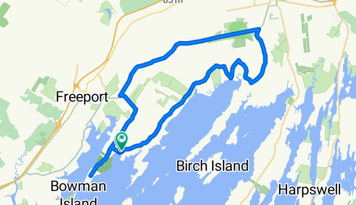
188–198 Burnett Rd, Freeport to 172–186 Burnett Rd, Freeport
A cycling route starting in Freeport, State of Maine, United States of America.
Overview
About this route
- 1 h 39 min
- Duration
- 35.1 km
- Distance
- 0 m
- Ascent
- 3 m
- Descent
- 21.2 km/h
- Avg. speed
- ---
- Avg. speed
Route quality
Waytypes & surfaces along the route
Waytypes
Quiet road
32.3 km
(92 %)
Road
2.7 km
(8 %)
Surfaces
Paved
8 km
(23 %)
Unpaved
4.1 km
(12 %)
Paved (undefined)
8 km
(23 %)
Unpaved (undefined)
4.1 km
(12 %)
Undefined
23 km
(65 %)
Continue with Bikemap
Use, edit, or download this cycling route
You would like to ride 188–198 Burnett Rd, Freeport to 172–186 Burnett Rd, Freeport or customize it for your own trip? Here is what you can do with this Bikemap route:
Free features
- Save this route as favorite or in collections
- Copy & plan your own version of this route
- Sync your route with Garmin or Wahoo
Premium features
Free trial for 3 days, or one-time payment. More about Bikemap Premium.
- Navigate this route on iOS & Android
- Export a GPX / KML file of this route
- Create your custom printout (try it for free)
- Download this route for offline navigation
Discover more Premium features.
Get Bikemap PremiumFrom our community
Other popular routes starting in Freeport
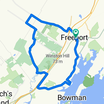
 Relaxed route in Freeport
- Distance
- 14.9 km
- Ascent
- 128 m
- Descent
- 181 m
- Location
- Freeport, State of Maine, United States of America
 So. Freeport 14 mile
- Distance
- 22.4 km
- Ascent
- 179 m
- Descent
- 178 m
- Location
- Freeport, State of Maine, United States of America
 Freeport - East Gray
- Distance
- 101.3 km
- Ascent
- 1,083 m
- Descent
- 1,083 m
- Location
- Freeport, State of Maine, United States of America
 188–198 Burnett Rd, Freeport to 172–186 Burnett Rd, Freeport
- Distance
- 35.1 km
- Ascent
- 0 m
- Descent
- 3 m
- Location
- Freeport, State of Maine, United States of America
 Bradbury Mt State Park Return by Bike
- Distance
- 32.7 km
- Ascent
- 141 m
- Descent
- 181 m
- Location
- Freeport, State of Maine, United States of America
 194 Lower Main St, Freeport to 87 Maine St, Brunswick
- Distance
- 17.7 km
- Ascent
- 199 m
- Descent
- 221 m
- Location
- Freeport, State of Maine, United States of America
 Wolfs Neck loop v2
- Distance
- 53.9 km
- Ascent
- 313 m
- Descent
- 306 m
- Location
- Freeport, State of Maine, United States of America
 73 South St, Freeport to 5 Park St, Freeport
- Distance
- 1.6 km
- Ascent
- 32 m
- Descent
- 7 m
- Location
- Freeport, State of Maine, United States of America
Open it in the app