

Schliersee Westlicher Höhenweg
A cycling route starting in Schliersee, Bavaria, Germany.
Overview
About this route
In Fischbach erst mal zum einlaufen gemütlich auf der linken Seite des See entlang, um dann immer steiler den Krainsberg hoch zu laufen bzw. mit dem Bike den Höhenweg zu bezwingen. Tolle Aussicht vom Höhenweg auf den Schliersee. Nach Fischbach runter geht´s dann ganz schön heftig. Die umgekehrte Runde lässt einem an dieser schier nicht endend wollenden Steil-Stelle das Wasser aus den Poren schießen.
- -:--
- Duration
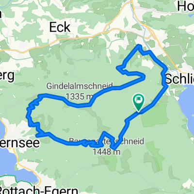
- 11.5 km
- Distance
- 425 m
- Ascent
- 423 m
- Descent
- ---
- Avg. speed
- ---
- Avg. speed

Continue with Bikemap
Use, edit, or download this cycling route
You would like to ride Schliersee Westlicher Höhenweg or customize it for your own trip? Here is what you can do with this Bikemap route:
Free features
- Save this route as favorite or in collections
- Copy & plan your own version of this route
- Sync your route with Garmin or Wahoo
Premium features
Free trial for 3 days, or one-time payment. More about Bikemap Premium.
- Navigate this route on iOS & Android
- Export a GPX / KML file of this route
- Create your custom printout (try it for free)
- Download this route for offline navigation
Discover more Premium features.
Get Bikemap PremiumFrom our community
Other popular routes starting in Schliersee
 Triathlonstrecke Hexal Alpentriathlon
- Distance
- 40 km
- Ascent
- 817 m
- Descent
- 491 m
- Location
- Schliersee, Bavaria, Germany
 Von Tegernsee bis Hausham
- Distance
- 55.1 km
- Ascent
- 1,307 m
- Descent
- 1,310 m
- Location
- Schliersee, Bavaria, Germany
 Valepprunde
- Distance
- 44.9 km
- Ascent
- 1,034 m
- Descent
- 1,031 m
- Location
- Schliersee, Bavaria, Germany
 Let's kill the Hill
- Distance
- 136.6 km
- Ascent
- 1,317 m
- Descent
- 1,316 m
- Location
- Schliersee, Bavaria, Germany
 Schliersee südliche Runde über Spitzingsee
- Distance
- 14.4 km
- Ascent
- 637 m
- Descent
- 634 m
- Location
- Schliersee, Bavaria, Germany
 Schliersee über Valepp zum Tegernsee und zurück
- Distance
- 28.6 km
- Ascent
- 591 m
- Descent
- 641 m
- Location
- Schliersee, Bavaria, Germany
 Schliersee - Tegernsee
- Distance
- 23.2 km
- Ascent
- 925 m
- Descent
- 925 m
- Location
- Schliersee, Bavaria, Germany
 Schliersee Tegernsee Rundfahrt
- Distance
- 54.2 km
- Ascent
- 364 m
- Descent
- 364 m
- Location
- Schliersee, Bavaria, Germany
Open it in the app