Premium Badge Download on the App Store Get it on Google Play Turn-by-turn Navigation Offline Maps Bike Type Optimized Routing Premium Maps Custom Bike Computer Export Routes Route Previews Fall Detection Premium Support

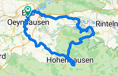
Cycling Route in Bad Oeynhausen, North Rhine-Westphalia, Germany

Stadt, Land, Fluss für Sportliche

0
Open this route in the Bikemap app

Open this route in the Bikemap app

Open this route in Bikemap Web

Open this route in Bikemap Web

65 km
Distance
478 m
Ascent
478 m
Descent
-:-- h
Duration
-- km/h
Avg. Speed
--- m
Max. Elevation

About This Route

Rund um Bad Oeynhausen

Die Tour ist mit ihren Steigungen anspruchsvoll und landschaftlich reizvoll. Vom Bad Oeynhausener Nordbahnhof geht es über die Lohe im Süden der Kurstadt weiter nach Vlotho im Kreis Herford, dann nach Kalletal im Lipperland weiter nach Varenholz. Zurück führt der Weg über Teile von Porta Westfalica zurück zum Parkplatz Sültebusch.

Anzeige

Länge: 65,1 km

Höhenmeter: 574 m

Anfangs- und Endpunkt:

Nordbahnhof Bad Oeynhausen

52°2.049‘ N | 8°79.665‘ O

Quelle NOZ

Customize this cycling route with the Bikemap route planner.

Make it yours!

Did you know? You can use this route as a template in our cycling route planner if you don't wish to start from scratch. Customize it based on your needs to plan your perfect cycling tour.

Open it in the app