

Zusam Radweg - Kaufb-Donauwörth
A cycling route starting in Kaufbeuren, Bavaria, Germany.
Overview
About this route
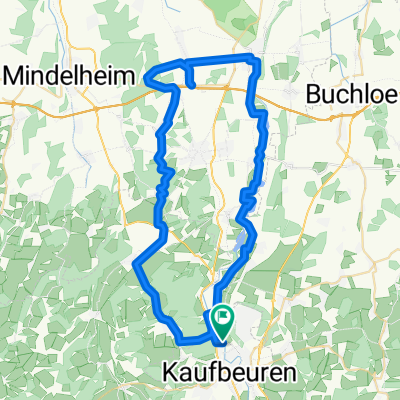
Auf 50 km Länge – von der Quelle bis Buttenwiesen – verläuft der Fluss im Naturpark Augsburg-Westliche Wälder. Der 129 km lange Zusam-Radweg führt von Kaufbeuren über Bad Wörishofen zur Quelle, dann flussabwärts bis Donauwörth. (Tourbeschreibung unter: thod_er@gmx.de)
- -:--
- Duration
- 128.9 km
- Distance
- 372 m
- Ascent
- 646 m
- Descent
- ---
- Avg. speed
- ---
- Avg. speed
Route quality
Waytypes & surfaces along the route
Waytypes
Quiet road
55.3 km
(43 %)
Road
24.8 km
(19 %)
Surfaces
Paved
92.3 km
(72 %)
Unpaved
9.6 km
(7 %)
Asphalt
88.1 km
(68 %)
Gravel
7.3 km
(6 %)
Continue with Bikemap
Use, edit, or download this cycling route
You would like to ride Zusam Radweg - Kaufb-Donauwörth or customize it for your own trip? Here is what you can do with this Bikemap route:
Free features
- Save this route as favorite or in collections
- Copy & plan your own version of this route
- Sync your route with Garmin or Wahoo
Premium features
Free trial for 3 days, or one-time payment. More about Bikemap Premium.
- Navigate this route on iOS & Android
- Export a GPX / KML file of this route
- Create your custom printout (try it for free)
- Download this route for offline navigation
Discover more Premium features.
Get Bikemap PremiumFrom our community
Other popular routes starting in Kaufbeuren
 Kaufbeuren - Frankenhofen - Oberzell - Bidingen - Bertolshofen - Rieden - Marktoberdorf - Kaufbeuren
- Distance
- 56.2 km
- Ascent
- 229 m
- Descent
- 232 m
- Location
- Kaufbeuren, Bavaria, Germany
 kleine Kaufbeurer Biergartenrunde
- Distance
- 18.9 km
- Ascent
- 255 m
- Descent
- 246 m
- Location
- Kaufbeuren, Bavaria, Germany
 Rund um Kaufbeuren
- Distance
- 57.1 km
- Ascent
- 228 m
- Descent
- 228 m
- Location
- Kaufbeuren, Bavaria, Germany
 Allgäu-Ostallgäu-Alm, Wallfahrtskirche und Kloster
- Distance
- 44.4 km
- Ascent
- 526 m
- Descent
- 525 m
- Location
- Kaufbeuren, Bavaria, Germany
 windbeutelessen
- Distance
- 37.4 km
- Ascent
- 372 m
- Descent
- 371 m
- Location
- Kaufbeuren, Bavaria, Germany
 Kaufbeuren-Marktoberdorf
- Distance
- 57.3 km
- Ascent
- 650 m
- Descent
- 650 m
- Location
- Kaufbeuren, Bavaria, Germany
 Kaufbeuren-Seeg
- Distance
- 32.1 km
- Ascent
- 282 m
- Descent
- 141 m
- Location
- Kaufbeuren, Bavaria, Germany
 Allgäu Skyline Park Runde
- Distance
- 58.8 km
- Ascent
- 324 m
- Descent
- 323 m
- Location
- Kaufbeuren, Bavaria, Germany
Open it in the app