

Heidekrug-Heidetränktal-Fuchstanz-Heidekrug
A cycling route starting in Oberursel, Hesse, Germany.
Overview
About this route
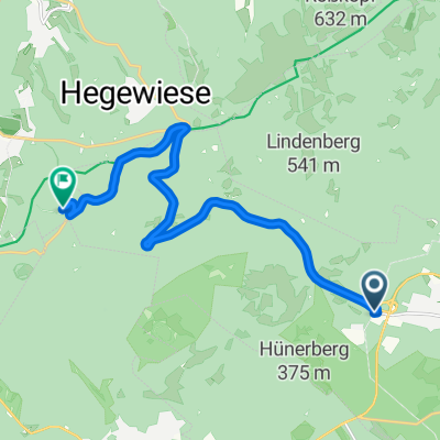
Die Strecke verläuft durch den Wald, zu einem großen Teil an einem Bach entlang. Steigungen sind meistens nur an den ersichtlichen Geraden vorhanden, die knackigste davon befindet sich oben an der 600m-Höhenlinie in der Nähe der Haarnadelkurve der L3004. Am Fuchstanz ist dann auch der höchste Punkt des Rundkurses erreicht. Von da an geht es fast nur noch bergab. Die Route wird entegegen des Uhrzeigersinn befahren.
- -:--
- Duration
- 19.1 km
- Distance
- 471 m
- Ascent
- 471 m
- Descent
- ---
- Avg. speed
- ---
- Avg. speed
Route quality
Waytypes & surfaces along the route
Waytypes
Track
14.2 km
(74 %)
Path
3.6 km
(19 %)
Surfaces
Paved
1.5 km
(8 %)
Unpaved
17.4 km
(91 %)
Gravel
8.9 km
(47 %)
Ground
4.1 km
(21 %)
Continue with Bikemap
Use, edit, or download this cycling route
You would like to ride Heidekrug-Heidetränktal-Fuchstanz-Heidekrug or customize it for your own trip? Here is what you can do with this Bikemap route:
Free features
- Save this route as favorite or in collections
- Copy & plan your own version of this route
- Sync your route with Garmin or Wahoo
Premium features
Free trial for 3 days, or one-time payment. More about Bikemap Premium.
- Navigate this route on iOS & Android
- Export a GPX / KML file of this route
- Create your custom printout (try it for free)
- Download this route for offline navigation
Discover more Premium features.
Get Bikemap PremiumFrom our community
Other popular routes starting in Oberursel
 Radstrecke Oberurseler Altstadtduathlon / Deutsche Meisterschaften
- Distance
- 9.1 km
- Ascent
- 121 m
- Descent
- 103 m
- Location
- Oberursel, Hesse, Germany
 Feldberg
- Distance
- 11.7 km
- Ascent
- 562 m
- Descent
- 15 m
- Location
- Oberursel, Hesse, Germany
 Taunusrunde - Hohemark - Feldberg - Ssandplacken
- Distance
- 34.5 km
- Ascent
- 867 m
- Descent
- 865 m
- Location
- Oberursel, Hesse, Germany
 Taunus-Runde mit Feldberg
- Distance
- 70.4 km
- Ascent
- 1,271 m
- Descent
- 1,271 m
- Location
- Oberursel, Hesse, Germany
 Bikeroute Naturpark Taunus
- Distance
- 19.3 km
- Ascent
- 0 m
- Descent
- 0 m
- Location
- Oberursel, Hesse, Germany
 Hohemark-Feldberg-Cross
- Distance
- 23.9 km
- Ascent
- 715 m
- Descent
- 715 m
- Location
- Oberursel, Hesse, Germany
 40km rund um Hohemark v2
- Distance
- 39.9 km
- Ascent
- 1,219 m
- Descent
- 1,219 m
- Location
- Oberursel, Hesse, Germany
 Taunustrails
- Distance
- 46.7 km
- Ascent
- 1,157 m
- Descent
- 867 m
- Location
- Oberursel, Hesse, Germany
Open it in the app