

Offenheimer Straße 40–64, Alzey nach Wilhelmstraße 2A, Bad Kreuznach
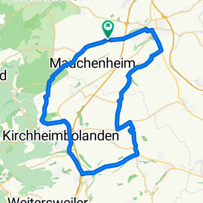
A cycling route starting in Mauchenheim, Rhineland-Palatinate, Germany.
Overview
About this route
- 1 h 18 min
- Duration
- 22.6 km
- Distance
- 258 m
- Ascent
- 367 m
- Descent
- 17.3 km/h
- Avg. speed
- ---
- Avg. speed
Route quality
Waytypes & surfaces along the route
Waytypes
Busy road
9 km
(40 %)
Road
4.9 km
(22 %)
Surfaces
Paved
21.1 km
(94 %)
Unpaved
0.3 km
(1 %)
Asphalt
17 km
(75 %)
Paving stones
2.6 km
(11 %)
Continue with Bikemap
Use, edit, or download this cycling route
You would like to ride Offenheimer Straße 40–64, Alzey nach Wilhelmstraße 2A, Bad Kreuznach or customize it for your own trip? Here is what you can do with this Bikemap route:
Free features
- Save this route as favorite or in collections
- Copy & plan your own version of this route
- Sync your route with Garmin or Wahoo
Premium features
Free trial for 3 days, or one-time payment. More about Bikemap Premium.
- Navigate this route on iOS & Android
- Export a GPX / KML file of this route
- Create your custom printout (try it for free)
- Download this route for offline navigation
Discover more Premium features.
Get Bikemap PremiumFrom our community
Other popular routes starting in Mauchenheim
 Kurze Runde
- Distance
- 39.9 km
- Ascent
- 401 m
- Descent
- 399 m
- Location
- Mauchenheim, Rhineland-Palatinate, Germany
 Alzey - Rundweg, 35 km, 150 hm
- Distance
- 34.3 km
- Ascent
- 112 m
- Descent
- 152 m
- Location
- Mauchenheim, Rhineland-Palatinate, Germany
 Alzey - Weingut Listmann, 22 km, 140 hm
- Distance
- 21.2 km
- Ascent
- 115 m
- Descent
- 151 m
- Location
- Mauchenheim, Rhineland-Palatinate, Germany
 Kurze Runde CLONED FROM ROUTE 82258
- Distance
- 40 km
- Ascent
- 397 m
- Descent
- 398 m
- Location
- Mauchenheim, Rhineland-Palatinate, Germany
 Alzey - Rossmarktbrunnen, 4,5 km, 40 hm
- Distance
- 4.2 km
- Ascent
- 23 m
- Descent
- 63 m
- Location
- Mauchenheim, Rhineland-Palatinate, Germany
 Variante II
- Distance
- 69.7 km
- Ascent
- 291 m
- Descent
- 322 m
- Location
- Mauchenheim, Rhineland-Palatinate, Germany
 Alzey - Stein Bockenheim, 13 km, 170 hm
- Distance
- 12.7 km
- Ascent
- 165 m
- Descent
- 192 m
- Location
- Mauchenheim, Rhineland-Palatinate, Germany
 Donnersbergrunde
- Distance
- 64.5 km
- Ascent
- 697 m
- Descent
- 473 m
- Location
- Mauchenheim, Rhineland-Palatinate, Germany
Open it in the app