

2011/04/02 萬眾騎福BIKE媽祖
A cycling route starting in Fengyuan, Taiwan, Taiwan.
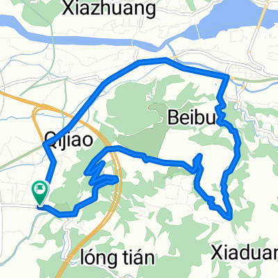
Overview
About this route
- -:--
- Duration
- 82.3 km
- Distance
- 501 m
- Ascent
- 502 m
- Descent
- ---
- Avg. speed
- ---
- Avg. speed

Route highlights
Points of interest along the route
Point of interest after 0.9 km
起點-大甲體育場 0km
Point of interest after 30.3 km
稽核點A-台中市政府 30km
Point of interest after 34.5 km
稽核點B-萬和宮 35km
Point of interest after 43.6 km
稽核點C-樂成宮 43km
Point of interest after 61 km
稽核點D-鎮清宮 60km
Continue with Bikemap
Use, edit, or download this cycling route
You would like to ride 2011/04/02 萬眾騎福BIKE媽祖 or customize it for your own trip? Here is what you can do with this Bikemap route:
Free features
- Save this route as favorite or in collections
- Copy & plan your own version of this route
- Sync your route with Garmin or Wahoo
Premium features
Free trial for 3 days, or one-time payment. More about Bikemap Premium.
- Navigate this route on iOS & Android
- Export a GPX / KML file of this route
- Create your custom printout (try it for free)
- Download this route for offline navigation
Discover more Premium features.
Get Bikemap PremiumFrom our community
Other popular routes starting in Fengyuan
 潭雅神綠園道 20220815 Tanya Shen Green Bikeway
- Distance
- 27.4 km
- Ascent
- 323 m
- Descent
- 323 m
- Location
- Fengyuan, Taiwan, Taiwan
 大雅至日月潭
- Distance
- 179.7 km
- Ascent
- 1,441 m
- Descent
- 1,438 m
- Location
- Fengyuan, Taiwan, Taiwan
 豐原-萬里長城-南坑巷
- Distance
- 22.4 km
- Ascent
- 466 m
- Descent
- 466 m
- Location
- Fengyuan, Taiwan, Taiwan
 公老坪繞圈
公老坪繞圈- Distance
- 14.1 km
- Ascent
- 320 m
- Descent
- 317 m
- Location
- Fengyuan, Taiwan, Taiwan
![6: Elephant nose [2200m climb]](https://media.bikemap.net/routes/1159343/staticmaps/in_ede61004-95c4-485e-a0b2-beea9d9d46dc_400x400_bikemap-2021-3D-static.png) 6: Elephant nose [2200m climb]
6: Elephant nose [2200m climb]- Distance
- 119.6 km
- Ascent
- 1,692 m
- Descent
- 1,692 m
- Location
- Fengyuan, Taiwan, Taiwan
 136 Rd.→Tianleng→Zhongxingling(136縣道+天冷+中興嶺)
- Distance
- 103 km
- Ascent
- 2,728 m
- Descent
- 2,489 m
- Location
- Fengyuan, Taiwan, Taiwan
 2009/6/20_二坪->公老坪->南坑->二坪
- Distance
- 20.8 km
- Ascent
- 546 m
- Descent
- 546 m
- Location
- Fengyuan, Taiwan, Taiwan
 20090523大雪山林道
- Distance
- 34 km
- Ascent
- 1,986 m
- Descent
- 308 m
- Location
- Fengyuan, Taiwan, Taiwan
Open it in the app