

Parcours 58-810
A cycling route starting in Saint-Clément, Aquitaine-Limousin-Poitou-Charentes, France.
Overview
About this route
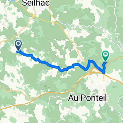
Bien, assez valloné, belle cote entre Vimbelle et Correze, mais surtout sortie de Correze vers St Augustin.
Dure quand il y a du vent, surtout sur le plateau entre Correze et Seilhac.
65 km au compteur
- -:--
- Duration
- 58 km
- Distance
- 689 m
- Ascent
- 689 m
- Descent
- ---
- Avg. speed
- ---
- Avg. speed
Continue with Bikemap
Use, edit, or download this cycling route
You would like to ride Parcours 58-810 or customize it for your own trip? Here is what you can do with this Bikemap route:
Free features
- Save this route as favorite or in collections
- Copy & plan your own version of this route
- Sync your route with Garmin or Wahoo
Premium features
Free trial for 3 days, or one-time payment. More about Bikemap Premium.
- Navigate this route on iOS & Android
- Export a GPX / KML file of this route
- Create your custom printout (try it for free)
- Download this route for offline navigation
Discover more Premium features.
Get Bikemap PremiumFrom our community
Other popular routes starting in Saint-Clément
 Route de Bruno Madranges,Uzerche
- Distance
- 61.6 km
- Ascent
- 630 m
- Descent
- 630 m
- Location
- Saint-Clément, Aquitaine-Limousin-Poitou-Charentes, France
 Parcours 58-810
- Distance
- 58 km
- Ascent
- 689 m
- Descent
- 689 m
- Location
- Saint-Clément, Aquitaine-Limousin-Poitou-Charentes, France
 Rando Clément 71km 19/6/11
- Distance
- 70.5 km
- Ascent
- 844 m
- Descent
- 844 m
- Location
- Saint-Clément, Aquitaine-Limousin-Poitou-Charentes, France
 Carl Patrice
- Distance
- 7.8 km
- Ascent
- 168 m
- Descent
- 144 m
- Location
- Saint-Clément, Aquitaine-Limousin-Poitou-Charentes, France
 St Mexant,Tulle, Vimbelle, Seilhac
- Distance
- 44.8 km
- Ascent
- 477 m
- Descent
- 477 m
- Location
- Saint-Clément, Aquitaine-Limousin-Poitou-Charentes, France
 Seilhac, Vigeois, St Pardoux
- Distance
- 48.1 km
- Ascent
- 496 m
- Descent
- 496 m
- Location
- Saint-Clément, Aquitaine-Limousin-Poitou-Charentes, France
 Suc au May
- Distance
- 71.7 km
- Ascent
- 927 m
- Descent
- 927 m
- Location
- Saint-Clément, Aquitaine-Limousin-Poitou-Charentes, France
 Route de Fabien
- Distance
- 49.9 km
- Ascent
- 535 m
- Descent
- 535 m
- Location
- Saint-Clément, Aquitaine-Limousin-Poitou-Charentes, France
Open it in the app