

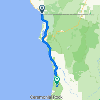
16399 Lower Harbor Rd, Brookings to 503 L St, Crescent City
A cycling route starting in Harbor, Oregon, United States of America.
Overview
About this route
- 2 h 33 min
- Duration
- 42.2 km
- Distance
- 128 m
- Ascent
- 134 m
- Descent
- 16.6 km/h
- Avg. speed
- ---
- Avg. speed

Route quality
Waytypes & surfaces along the route
Waytypes
Busy road
13.1 km
(31 %)
Road
12.3 km
(29 %)
Surfaces
Paved
17.6 km
(42 %)
Asphalt
17.6 km
(42 %)
Undefined
24.6 km
(58 %)
Continue with Bikemap
Use, edit, or download this cycling route
You would like to ride 16399 Lower Harbor Rd, Brookings to 503 L St, Crescent City or customize it for your own trip? Here is what you can do with this Bikemap route:
Free features
- Save this route as favorite or in collections
- Copy & plan your own version of this route
- Sync your route with Garmin or Wahoo
Premium features
Free trial for 3 days, or one-time payment. More about Bikemap Premium.
- Navigate this route on iOS & Android
- Export a GPX / KML file of this route
- Create your custom printout (try it for free)
- Download this route for offline navigation
Discover more Premium features.
Get Bikemap PremiumFrom our community
Other popular routes starting in Harbor
 Brookings - Klamath
- Distance
- 92.4 km
- Ascent
- 815 m
- Descent
- 704 m
- Location
- Harbor, Oregon, United States of America
 U.S. 101 14345, Brookings to U.S. 101 725, Crescent City
- Distance
- 32.4 km
- Ascent
- 100 m
- Descent
- 112 m
- Location
- Harbor, Oregon, United States of America
 Home to eureka
- Distance
- 156.4 km
- Ascent
- 1,020 m
- Descent
- 1,031 m
- Location
- Harbor, Oregon, United States of America
 Oregon to Berkeley
- Distance
- 687.3 km
- Ascent
- 11,135 m
- Descent
- 11,137 m
- Location
- Harbor, Oregon, United States of America
 Directions from Ted King Start to Leg 1 - Ted King Start - Leg 1
- Distance
- 170 km
- Ascent
- 2,397 m
- Descent
- 2,414 m
- Location
- Harbor, Oregon, United States of America
 248 W First St, Smith River to 1770 Northcrest Dr, Crescent City
- Distance
- 19.8 km
- Ascent
- 14 m
- Descent
- 32 m
- Location
- Harbor, Oregon, United States of America
 california border to Elk Prairie St park
- Distance
- 92.3 km
- Ascent
- 749 m
- Descent
- 697 m
- Location
- Harbor, Oregon, United States of America
 CA2014 - Day 7
- Distance
- 139.1 km
- Ascent
- 1,206 m
- Descent
- 1,201 m
- Location
- Harbor, Oregon, United States of America
Open it in the app