

Montafon Mountainbike Marathon M2 - anspruchsvoll
A cycling route starting in Schruns, Vorarlberg, Austria.
Overview
About this route
Durch Waldgebiete führt die Strecke ins Hochmoor Wildried Silbertal, dann über den Kristberg vorbei an den Tora-, Fula- und Fritzenseen zum Fuße des Itonskopf. Ein weiterer Höhepunkt wird dann der Abschnitt nach dem Rellseck. Über den Bartholomäberg führt ein anspruchsvoller, steiler, sehr exponierter und schmaler Single-Trail durch den Gaueser Wald, vorbei am Kloster Gauenstein bis nach Gantschier. Das Finale wird über den dritten großen Anstieg der Strecke auf dem Weg ins Rätikon eingeleitet.
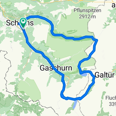
Schruns – Silbertal – Kristberg – Rellseck – Bartholomäberg – Gantschier – Vadans – Matschwitz – Latschau – Bitschweil – Schruns
- -:--
- Duration
- 64.5 km
- Distance
- 2,149 m
- Ascent
- 2,149 m
- Descent
- ---
- Avg. speed
- ---
- Avg. speed

Route highlights
Points of interest along the route
Point of interest after 19.2 km
Zwischenzeit Kristberg
Point of interest after 20.3 km
TAZ01 Kristberg
Point of interest after 25.6 km
Trennung M1 und M2/M3 Strecke
Point of interest after 31 km
Einmündung M2/M3 in M1 Strecke
Point of interest after 36.9 km
TAZ02 Bartholomäberg
Point of interest after 40.5 km
Zwischenzeit Gantschier
Point of interest after 40.6 km
Trennung M2/M3 und M1 Strecke Zeitlimit 13:00 Uhr
Point of interest after 43.4 km
TAZ03 Vandans
Point of interest after 52.4 km
TAZ04 Latschau
Point of interest after 59.7 km
Einmündung M2/M3 in M1/Mfit Strecke
Point of interest after 61.7 km
Trennung M1/M2 und M3/Mfit Zeitlimit 12:15 Uhr
Continue with Bikemap
Use, edit, or download this cycling route
You would like to ride Montafon Mountainbike Marathon M2 - anspruchsvoll or customize it for your own trip? Here is what you can do with this Bikemap route:
Free features
- Save this route as favorite or in collections
- Copy & plan your own version of this route
- Sync your route with Garmin or Wahoo
Premium features
Free trial for 3 days, or one-time payment. More about Bikemap Premium.
- Navigate this route on iOS & Android
- Export a GPX / KML file of this route
- Create your custom printout (try it for free)
- Download this route for offline navigation
Discover more Premium features.
Get Bikemap PremiumFrom our community
Other popular routes starting in Schruns
 schruns partenen heilbronner hütte silbertal schruns
- Distance
- 75.7 km
- Ascent
- 2,289 m
- Descent
- 2,290 m
- Location
- Schruns, Vorarlberg, Austria
 schruns partenen heilbronner hütte silbertal schruns
- Distance
- 75.8 km
- Ascent
- 2,255 m
- Descent
- 2,258 m
- Location
- Schruns, Vorarlberg, Austria
 2011_2_Vorarlberg-Tirol-Allgäu-Runde (BAFGOR)_Tschagguns - See
- Distance
- 74.9 km
- Ascent
- 1,398 m
- Descent
- 1,068 m
- Location
- Schruns, Vorarlberg, Austria
 Tschagguns - Latschau - Vadans - Schruns
- Distance
- 24.6 km
- Ascent
- 984 m
- Descent
- 986 m
- Location
- Schruns, Vorarlberg, Austria
 Mein erster Alpenpass vom 17. August 2017
- Distance
- 157.3 km
- Ascent
- 4,742 m
- Descent
- 4,730 m
- Location
- Schruns, Vorarlberg, Austria
 MeHC 2023
- Distance
- 9.9 km
- Ascent
- 1,174 m
- Descent
- 6 m
- Location
- Schruns, Vorarlberg, Austria
 Vandans - Schweizer Tor - Lindauer Hütte
- Distance
- 35.4 km
- Ascent
- 1,680 m
- Descent
- 1,687 m
- Location
- Schruns, Vorarlberg, Austria
 M fit Montafon Mountainbike Marathon
- Distance
- 29.4 km
- Ascent
- 377 m
- Descent
- 377 m
- Location
- Schruns, Vorarlberg, Austria
Open it in the app