

LP1 (Western)
A cycling route starting in Singapore, Central Singapore Community Development Council, Singapore.
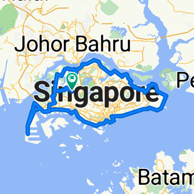
Overview
About this route
Start: Sembawang Rd --> Sembawang Vista --> Sembawang Drive
Sembawang Park Connector --> Admiralty Rd West --> Admiralty West Park Connector
Woodlands Waterfront Park (Toilet)
Admiralty Rd West --> Marsilling Park Connector
Woodlands Centre Rd --> Woodlands Rd
Kranji Road --> Kranji Loop --> Kranji Way (Toilet)
Neo Tiew Rd (1.8km)
Lim Chu Kang Lane 3 --> Lim Chu Kang Rd
Jln Bahar --> Nanyang Ave --> Nanyang Crescent
Pioneer Rd North --> Jurong West Street 91 (coffeeshop)
Yunnan Crescent --> Jurong West St 93
Upper Jurong Rd --> Benoi Rd
Gul Circle --> Tuas ViaDuct --> Pioneer Rd
Tuas West Rd --> Tuas Ave 3 --> Tuas South Blvd
Destination: LP1
Tuas Ave 14 --> Tuas ave 5 --> Tuas Crescent --> Tuas Ave 2 --> Tuas Ave 3
Tuas Rd --> Jln Ahmad Ibrahim
Jurong Park Connector
Enterprise Rd --> Jln Boon Lay
Con't Jurong Park Connector
Yuan Ching Rd --> Boon Lay Way
Ulu Pandan Park Connector (must cross river)
Ulu Pandan Road --> Holland Rd (Esso Station)
Tanglin Rd --> Orchard Rd --> Scotts Rd
Newton Circus --> Newton Rd
Thomson Rd --> Marymount Rd
AMK Park Connector
AMK Ave 6
Lentor Ave --> Yishun Park Connector
Yishun Ring Rd --> Yishun Ave 5
Sembawang Rd (End)
- -:--
- Duration
- 106.1 km
- Distance
- 165 m
- Ascent
- 164 m
- Descent
- ---
- Avg. speed
- 33 m
- Avg. speed
Continue with Bikemap
Use, edit, or download this cycling route
You would like to ride LP1 (Western) or customize it for your own trip? Here is what you can do with this Bikemap route:
Free features
- Save this route as favorite or in collections
- Copy & plan your own version of this route
- Sync your route with Garmin or Wahoo
Premium features
Free trial for 3 days, or one-time payment. More about Bikemap Premium.
- Navigate this route on iOS & Android
- Export a GPX / KML file of this route
- Create your custom printout (try it for free)
- Download this route for offline navigation
Discover more Premium features.
Get Bikemap PremiumFrom our community
Other popular routes starting in Singapore
 Tampines Simei Loop
- Distance
- 14.2 km
- Ascent
- 94 m
- Descent
- 91 m
- Location
- Singapore, Central Singapore Community Development Council, Singapore
 First Round Island for 2021
- Distance
- 122.5 km
- Ascent
- 1,707 m
- Descent
- 1,705 m
- Location
- Singapore, Central Singapore Community Development Council, Singapore
 Coast 2 Coast Loop (PCN)
- Distance
- 98.3 km
- Ascent
- 1,007 m
- Descent
- 1,007 m
- Location
- Singapore, Central Singapore Community Development Council, Singapore
 6A Rhu Cross, Tanjong Rhu to 6A Rhu Cross, Tanjong Rhu
- Distance
- 14.5 km
- Ascent
- 113 m
- Descent
- 143 m
- Location
- Singapore, Central Singapore Community Development Council, Singapore
 RTI CHILL RIDE
- Distance
- 173.2 km
- Ascent
- 191 m
- Descent
- 197 m
- Location
- Singapore, Central Singapore Community Development Council, Singapore
 SG RTI Clockwise Start ECP
- Distance
- 120.3 km
- Ascent
- 171 m
- Descent
- 168 m
- Location
- Singapore, Central Singapore Community Development Council, Singapore
 Round Island (+TP1)
- Distance
- 155.6 km
- Ascent
- 1,028 m
- Descent
- 1,029 m
- Location
- Singapore, Central Singapore Community Development Council, Singapore
 170C Punggol Field, Punggol to Punggol East, Punggol
- Distance
- 86 km
- Ascent
- 10 m
- Descent
- 30 m
- Location
- Singapore, Central Singapore Community Development Council, Singapore
Open it in the app