

th299 Neuköllner Mittenwalder Eisenbahn
A cycling route starting in Alt-Treptow, Land Berlin, Germany.
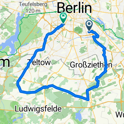
Overview
About this route
- -:--
- Duration
- 52.1 km
- Distance
- 66 m
- Ascent
- 67 m
- Descent
- ---
- Avg. speed
- 53 m
- Avg. speed

Route quality
Waytypes & surfaces along the route
Waytypes
Quiet road
18 km
(35 %)
Path
13.1 km
(25 %)
Surfaces
Paved
36.3 km
(70 %)
Unpaved
8.6 km
(16 %)
Asphalt
28.3 km
(54 %)
Paving stones
5.8 km
(11 %)
Continue with Bikemap
Use, edit, or download this cycling route
You would like to ride th299 Neuköllner Mittenwalder Eisenbahn or customize it for your own trip? Here is what you can do with this Bikemap route:
Free features
- Save this route as favorite or in collections
- Copy & plan your own version of this route
- Sync your route with Garmin or Wahoo
Premium features
Free trial for 3 days, or one-time payment. More about Bikemap Premium.
- Navigate this route on iOS & Android
- Export a GPX / KML file of this route
- Create your custom printout (try it for free)
- Download this route for offline navigation
Discover more Premium features.
Get Bikemap PremiumFrom our community
Other popular routes starting in Alt-Treptow
 Spaki
Spaki- Distance
- 24.5 km
- Ascent
- 120 m
- Descent
- 126 m
- Location
- Alt-Treptow, Land Berlin, Germany
 Fahren & Fressen: Yogihaus
- Distance
- 64.9 km
- Ascent
- 85 m
- Descent
- 79 m
- Location
- Alt-Treptow, Land Berlin, Germany
 Erkundungstour Rangsdorf
- Distance
- 114.5 km
- Ascent
- 114 m
- Descent
- 111 m
- Location
- Alt-Treptow, Land Berlin, Germany
 Am Treptower Park 72, Berlin nach Wildau
- Distance
- 34.5 km
- Ascent
- 90 m
- Descent
- 96 m
- Location
- Alt-Treptow, Land Berlin, Germany
 Ins Dahme-Seengebiet
- Distance
- 90.7 km
- Ascent
- 103 m
- Descent
- 103 m
- Location
- Alt-Treptow, Land Berlin, Germany
 Rund-um-den-BBI-Rennradrunde
- Distance
- 89.8 km
- Ascent
- 124 m
- Descent
- 123 m
- Location
- Alt-Treptow, Land Berlin, Germany
 Feierabend
- Distance
- 66.1 km
- Ascent
- 64 m
- Descent
- 67 m
- Location
- Alt-Treptow, Land Berlin, Germany
 Treptow-SXF-Mittenwalde-Gr. Machnow-KW-Grünau-Treptow
- Distance
- 88.8 km
- Ascent
- 135 m
- Descent
- 133 m
- Location
- Alt-Treptow, Land Berlin, Germany
Open it in the app