Premium Badge Download on the App Store Get it on Google Play Turn-by-turn Navigation Offline Maps Bike Type Optimized Routing Premium Maps Custom Bike Computer Export Routes Route Previews Fall Detection Premium Support

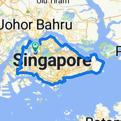
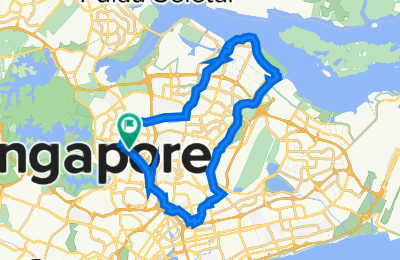
Cycling Route in Singapore, Central Singapore Community Development Council, Singapore

SG 36km 'PUNGGOL POINT' SOLO NITE RIDE (Tentative Thursday 5/8)

14
Open this route in the Bikemap app

Open this route in the Bikemap app

Open this route in Bikemap Web

Open this route in Bikemap Web

36 km
Distance
139 m
Ascent
140 m
Descent
-:-- h
Duration
-- km/h
Avg. Speed
38 m
Max. Elevation

About This Route

36km 'PUNGGOL POINT' SOLO NITE RIDE (Tentative Thursday 5/8)

(McDonald's Bishan - Punggol Point Prominade Walk - Kallang PC - McDonald's Bishan)

...............................................................

Start at McDonald's Bishan (7pm)

Ang Mo Kio A6/5 PC - Punggol PC - Jewel Bridge - Punggol Jetty = 12km (8pm)

Punggol Prominade - Lor Halus Red Bridge = 5km (8.30pm)  

Sungei Serangoon PC - Hougang A7 - Tampines Rd - Hougang A3 - Airport Rd - BreadTalk HQ = 9km (9.30pm)  

Paya Lebar Rd - Pelton River - Circuit Rd FOOD = 2km (10pm - 11pm = SUPPER)  

Aljunied Rd - Kallang Way - Genting Ln - Kallang River - McD's Bishan = 8km (Midnite)

This route is based on SG 44km (PUNGGOL END ) .

Customize this cycling route with the Bikemap route planner.

Make it yours!

Did you know? You can use this route as a template in our cycling route planner if you don't wish to start from scratch. Customize it based on your needs to plan your perfect cycling tour.

Open it in the app