

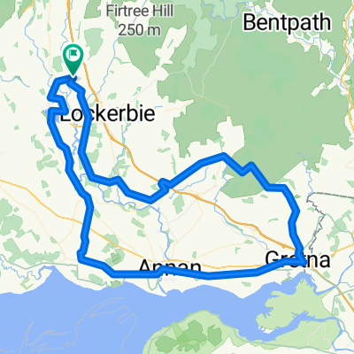
'Fechan, W'beck, Chapelknowe, Gretna, Annan, Lochmaben
A cycling route starting in Lochmaben, Scotland, United Kingdom.
Overview
About this route
Rail access at Annan and Gretna (or just off route, at Lockerbie). Facilities at Annan, Gretna and Lochmaben (and Lockerbie) with a shop and pub also at Ecclefechan. The section Gretna to Ruthwell via Annan has a wee bit traffic but nothing much. Otherwise the roads are very quiet. Between Powfoot and Ruthwell another quiet road lies just south and is the sustrans route - worth doing for a change. There is a great link north on minor roads from Annan to Hoddom via Brydekirk which splits this into two shorter loops
- -:--
- Duration
- 91.2 km
- Distance
- 266 m
- Ascent
- 264 m
- Descent
- ---
- Avg. speed
- ---
- Max. altitude

Route quality
Waytypes & surfaces along the route
Waytypes
Road
29.2 km
(32 %)
Quiet road
16.4 km
(18 %)
Surfaces
Paved
10 km
(11 %)
Asphalt
10 km
(11 %)
Undefined
81.1 km
(89 %)
Continue with Bikemap
Use, edit, or download this cycling route
You would like to ride 'Fechan, W'beck, Chapelknowe, Gretna, Annan, Lochmaben or customize it for your own trip? Here is what you can do with this Bikemap route:
Free features
- Save this route as favorite or in collections
- Copy & plan your own version of this route
- Split it into stages to create a multi-day tour
- Sync your route with Garmin or Wahoo
Premium features
Free trial for 3 days, or one-time payment. More about Bikemap Premium.
- Navigate this route on iOS & Android
- Export a GPX / KML file of this route
- Create your custom printout (try it for free)
- Download this route for offline navigation
Discover more Premium features.
Get Bikemap PremiumFrom our community
Other popular routes starting in Lochmaben
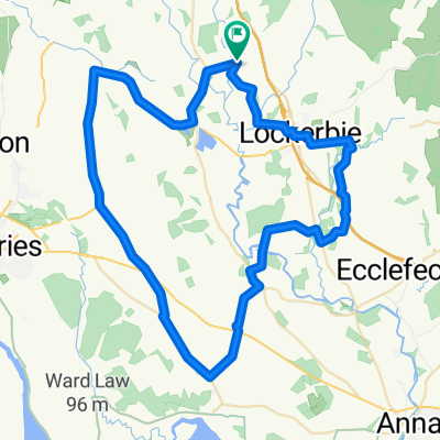
 LEJOG 2010 - Stage Eight
- Distance
- 167.9 km
- Ascent
- 562 m
- Descent
- 636 m
- Location
- Lochmaben, Scotland, United Kingdom
 'Fechan, W'beck, Chapelknowe, Gretna, Annan, Lochmaben
- Distance
- 91.2 km
- Ascent
- 266 m
- Descent
- 264 m
- Location
- Lochmaben, Scotland, United Kingdom
 06 vanaf Lochmaben
- Distance
- 71.7 km
- Ascent
- 604 m
- Descent
- 442 m
- Location
- Lochmaben, Scotland, United Kingdom
 Millhousebridge-SamyeLing-Waterbeck-(Brydekirk)-Kettleholm-Lockerbie-Millhousebridge
- Distance
- 88.7 km
- Ascent
- 470 m
- Descent
- 472 m
- Location
- Lochmaben, Scotland, United Kingdom
 Mid Annandale, Canonbie, Catlowdy, Carlisle, Gretna and return
- Distance
- 130.3 km
- Ascent
- 439 m
- Descent
- 439 m
- Location
- Lochmaben, Scotland, United Kingdom
 Millhouse', Shieldhill, T'th'wald, M'wald, Dalton, Scroggs Bridge return
- Distance
- 58.5 km
- Ascent
- 329 m
- Descent
- 329 m
- Location
- Lochmaben, Scotland, United Kingdom
 Lockerbie,Langholm, Canonbie,'Fechan,Applegarth
- Distance
- 90 km
- Ascent
- 497 m
- Descent
- 497 m
- Location
- Lochmaben, Scotland, United Kingdom
 Lockerbie, Sheildhill, Torthorwald, Dalton
- Distance
- 43.9 km
- Ascent
- 307 m
- Descent
- 310 m
- Location
- Lochmaben, Scotland, United Kingdom
Open it in the app